


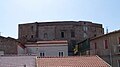

- Most beautiful villages
Photo: Nyx NK, CC BY-SA 4.0 · Wikimedia Commons
Irsina, until 1895 called Montepeloso (in local dialect: Montepelòse or Mondepelòse), is a town, comune (municipality) and former Latin bishopric in the province of Matera, in the Southern Italian region of Basilicata. It is one of I Borghi più belli d'Italia ("The most beautiful villages of Italy").
Irsina is an agricultural town perched 550 metres (1,800 ft) above sea level. The town overlooks a grain plateau which produces much of the pasta used across Italy. The economy is mostly based on agriculture, with the production of cereals and wine.
With a population of about 5,000 people in 2,000 households, Irsina sits on the border between the Southern Italian regions of Puglia (Apulia) and Basilicata, within the Council of Materia.
The geography of the town is very simple. The new town is joined to the old by a modern main street which has now become the commercial focus, with small bars, shops and cafes, surrounded by much housing.
Ancient walls embrace the historical centre. Entering through the town gates, there is a medieval part of Irsina with a labyrinth of cobblestone roads winding and opening up into little squares with scenic views over the vast countryside. Ancient watchtowers, small churches, elegant buildings and small fountains are familiar landmarks. There is a 13th-century cathedral which was partly rebuilt at the end of the 18th century. The remains of a Norman castle have since been incorporated into the crypt of the former monastery of San Francesco.
The numerous archaeological finds, vases, Greek and Roman coins, weapons, furnishings, and various Italo-Greek relics, that have been found inside and outside Irsina, testify to its ancient grandeur during the Greek-Roman period.
The medieval history of Montepeloso starts from AD 895, the year in which the city was invaded by the Saracens. They were attempting to invade the southerly regions of Benevento (north-east of Napoli). They occupied many settlements in this region, which was at that time called Lucania. In 988 Montepeloso was besieged and again destroyed by the Saracens. Rebuilt by the Prince of Salerno Giovanni II, after his death (in about 998), it became the scene of bloody battles between the Muslims and the Byzantines.
In 1042, Montepeloso was the scene of a great battle between the Byzantine and the Norman armies. The Byzantine army was headed by Augustus Bugiano (Boioannes); the Norman forces are controlled by Atenolfo, brother of the Prince of Benevento. The knights are led by William of Altavilla and Argiro. The Byzantines are defeated by the Norman troops following which the town passed into Norman rule. According to the chronicle of the Beloved of Montecassino, Tristan, knight of the lineage Altavilla in the territory of the Vulture, is the first Norman Count of Montepeloso, one of the twelve baronies of which composes the County of Puglia.
In 1123, Pope Callisto II elected Montepeloso as a bishopric, perhaps to counter the presence of a strong Orthodox-Byzantine minority that still existed in the country. In 1132, Montepeloso joined the revolt of the Apulian Barons against Ruggero II, King of Sicily and Puglia, and was occupied by one of these Barons, Tancredi di Conversano, Count of Brindisi. A year later, Ruggero II punished the town for taking the side of the rebel Tancredi and it was razed to the ground and the inhabitants murdered. …
Irsina has a community of residents from across the world – including the USA, Britain, Ireland, South Africa and Belgium – who live there either full-time or have holiday homes. The village hosts annual Italian language courses, art events, and an international film festival.
The Aranacea cultural hub is owned publicly by the municipality. Irsina is just coming onto the tourist radar.
The village is one hour from Bari Airport (Ryanair), and an hour and a half from Brindisi airport (also Ryanair). It is one hour from the beach, and thirty minutes from Matera. The countryside is interspersed with rivers, lakes, fields, woods and archaeological ruins.
Text from Wikipedia, the free encyclopedia, under CC BY-SA 4.0. Full article: «Irsina».
Distances are as the crow flies, not walking or driving.


Irsina is in Irsina, in the province of Matera (Basilicata), Italy. GPS coordinates: 40.75000, 16.23333.
Nearby you’ll find: Palazzo Materi (13.6 km away), Castello di Monteserico (13.6 km away), Silvium (16 km away).
Text. Wikipedia, the free encyclopedia (CC BY-SA 4.0).
Data. Wikidata (CC0); opening hours and contacts OpenStreetMap (ODbL).
Photos. Wikimedia Commons, author and licence on every image.
Updated 28 October 2026. All sources and licences