



- UNESCO
- Free 1st Sunday
Photo: Agsftw, CC BY-SA 3.0 · Wikimedia Commons
Archaeological site
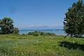
Ruins of a Roman villa in Sirmione, Italy
Grottoes of Catullus is the name given to the ruins of a Roman villa built between the end of the 1st century BC and the beginning of the 1st century AD at the northernmost end of the Sirmione peninsula on the southern shore of Lake Garda.
The archaeological complex, which always remained uncovered over time, has been the subject of academic research since the 15th century. Today, it is the most valuable testament of the Roman period in Sirmione's territory and an exceptional find of a Roman villa in northern Italy. The site, which includes the archaeological museum of Sirmione, was the twenty-seventh most visited Italian site in 2013, with 215,961 visitors and a total gross income of €504,700.
The large villa, under which structures of the 1st century BC were found, was built at the beginning of the 1st century AD. The villa must have been abandoned in the 3rd century when part of its architectural decoration was reused in the other Roman villa in Sirmione located on the present-day via Antiche Mura. Between the 4th and 5th centuries, the villa's imposing surviving structures were included in the fortifications that enclosed the Sirmione peninsula and burials were built inside the remains of the Roman building, used as a cemetery.
Over the centuries, several chroniclers and travellers visited the ruins. However, the first comprehensive studies were conducted in 1801 by General Lacombe-Saint-Michel, the Napoleonic army commander. Subsequently, the Veronese count Giovanni Girolamo Orti Manara performed some excavations and surveys published in 1856.
In 1939, the National Superintendence for Archaeological Heritage started an extensive excavations and restorations program; it acquired the entire area in 1948 to guarantee adequate protection of the complex and its natural environment. During the 1990s, further studies confirmed that the construction was carried out through a unitary project, which defined the orientation and distribution of the internal spaces according to a precise axiality and symmetry criterion. An archaeological museum collecting finds from the area was inaugurated in 1999.
In the 2010s, a recovery program of the historic olive grove has been completed. About 1500 olive trees, some centuries old, are currently present across the whole site, belonging to three different varieties typical of the area (casaliva, leccino and gargnà). The olive harvest to produce extra virgin olive oil resumed in 2012.
The archaeological complex, still partially unearthed today, covers an area of about two hectares. The villa has a rectangular plan of 167 × 105 m with two foreparts on the north and south sides. To overcome the inclination of the rocky bank on which the building was set, large support structures, called substructions, were created in the northern part, and substantial cuts were made to model the rocky bank.
The main floor, corresponding to the owner's home, is the most damaged, both because it was the most exposed and because the villa, after its abandonment, has been a quarry for materials for several centuries. The intermediate and lower floors instead are better preserved.
The main entrance to the building was in the southern forepart. The villa was characterized by long porches and terraces open towards the lake along the east and west sides, communicating to the north with a large belvedere terrace, equipped with a velarium.Along the western side, there is a cryptoporticus, a long walk once covered. The residential parts of the building were in the north and south areas, while the central region, made up today of the grande oliveto, was occupied by a garden. On the southern side, under an opus spicatum floor, there is a large cistern almost forty-three meters long, which collected the water necessary for daily use. The extensive thermal sector of the villa, consisting of several rooms located in the south-western area, including a swimming pool, was probably obtained at the beginning of the 2nd century.
The various rooms of the villa have suggestive conventional names, derived from established local tradition or interpretations formulated during the first excavations. On the northern side of the ruins can be found l'Aula dei tre pilastri ("The three-pillar hall"), il lungo corridoio ("The long corridor"), la trifora del paradiso ("The trifora of heaven"), il grande pilone ("The big pylon"), la grotta del cavallo ("The horse cave") and l'aula dei giganti ("The hall of giants").
Text from Wikipedia, the free encyclopedia, under CC BY-SA 4.0. Full article: «Grottoes of Catullus».
Distances are as the crow flies, not walking or driving.


Capo di Ponte (BS)


Grottoes of Catullus is in Sirmione, in the province of Brescia (Lombardy), Italy. Address: piazzale Orti Manara, 4. GPS coordinates: 45.50145, 10.60645.
There is an admission charge, but entry is free on the first Sunday of the month (Domenica al museo). Up-to-date prices are on the official website.
According to OpenStreetMap data, the site is wheelchair accessible.
Nearby you’ll find: Museo archeologico di Sirmione (100 m away), Scaligero Castle (1 km away), Lugana Vecchia (3.8 km away).
Text. Wikipedia, the free encyclopedia (CC BY-SA 4.0).
Data. Wikidata (CC0); opening hours and contacts OpenStreetMap (ODbL).
Photos. Wikimedia Commons, author and licence on every image.
Updated 28 October 2026. All sources and licences