


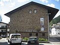


Photo: 2015 Michael 2015, CC BY-SA 4.0 · Wikimedia Commons
Fortress / Tower, 1888
Fort Plätzwiese
Austrian fortification in the Dolomites
Toblach (BZ), Trentino-South Tyrol
At a glance
- Type
- Fortress / Tower
- Period
- Modern era, 1888
- Protection
- Cultural heritage monument in South Tyrol
- Coordinates
- 46°38′30″ N, 12°11′43″ E
About
The Platwiese roadblock is an Austro-Hungarian fortification built in the Veneto region of Northern Italy. Platwiese was built between 1889 and 1894, and was the first “armored” fortification built by Austria-Hungary. The construction was dragged out because of the relatively short construction period in the Dolomites. Due to the outdated materials used, by 1900 the structure was under consideration to be replaced by a more up-to-date structure. In the spring of 1915, a cave system was drilled nearby as a replacement structure for the guns.
On July 4th, 1915, the roadblock was lightly shelled by Italian heavy guns, with 4 hits being recorded. Of these, 1 punched through the stone armor of the front, and went deep into the building and exploded. The other notable hit was when a heavy shell split 1 of the 2 armored domes still emplaced at the fort. Until 1917, the fort was closely watched by Italian artillery, so the roadblock was never reinforced or occupied by infantry. The structure was made safe in 2011, and is now a protected monument. The roadblock was crewed by 5 officers and 104 enlisted men.
Text from Wikipedia, the free encyclopedia, under CC BY-SA 4.0. Full article: «Fort Plätzwiese».
Timeline
- 1888Built
Events and people from Wikidata (CC0).
Photos
Getting there
Toblach - DobbiacoTrain, nearest
9.5 km as the crow flies
Fort Plätzwiese
Distances are as the crow flies, not walking or driving.
Loading map…
Nearby
See on the mapMore fortresses and towers in Trentino-South Tyrol


Frequently asked questions
Where is Fort Plätzwiese?
Fort Plätzwiese is in Toblach, in the province of Bolzano (Trentino-South Tyrol), Italy. GPS coordinates: 46.64170, 12.19528.
How old is Fort Plätzwiese?
Wikidata dates it to 1888.
What else is there to see near Fort Plätzwiese?
Nearby you’ll find: Fort Landro (2.9 km away), Herbstenburg (10.7 km away), MIK Museum im Kapitel (12.2 km away).
Sources and licences
Text. Wikipedia, the free encyclopedia (CC BY-SA 4.0).
Data. Wikidata (CC0); opening hours and contacts OpenStreetMap (ODbL).
Photos. Wikimedia Commons, author and licence on every image.
Credits for the 9 photos
- Werk Plätzwiese 2018-06-27 — 2015 Michael 2015, CC BY-SA 4.0
- Croda Rossa e Forte Prato Piazza — Llorenzi, CC BY-SA 3.0
- Forte Prato Piazza 01 — Llorenzi, CC BY-SA 4.0
- Plätzwiese Fort am Strudelkopfsattel -2017-09-21-12-18-26 — Alexander Hoernigk, CC BY-SA 4.0
- Plätzwiese Fort am Strudelkopfsattel -2017-09-21-13-39-46 — Alexander Hoernigk, CC BY-SA 4.0
- Rifugio Vallandro e Forte Prato Piazza dal sentiero n. 40 — Llorenzi, CC BY-SA 3.0
- Alte Sperre auf Plätzwiese (BildID 15736272) — K.u.k. Kriegspressequartier, Lichtbildstelle - Wien, Public domain
- J40 089 Werk Plätzwiese, Monte Cristallo — Falk2, CC BY-SA 4.0
- J40 090 Werk Plätzwiese, Monte Cristallo — Falk2, CC BY-SA 4.0
Updated 28 October 2026. All sources and licences