





Photo: Llorenzi, CC BY-SA 4.0 · Wikimedia Commons
Fortress / Tower, 1862
Fort Doss di Sponde
Building in Cadine, Italy
Trento (TN), Trentino-South Tyrol
At a glance
- Type
- Fortress / Tower
- Period
- Modern era, 1862
- Protection
- Italian national heritage
- Coordinates
- 46°04′50″ N, 11°04′20″ E
About
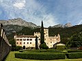
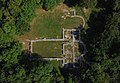
The Doss di Sponde blockhouse is a 19th century Austro-Hungarian fortification built to protect the city of Trento from an attack down the Vela Valley. The fort was built between 1860-62 just slightly upstream from Fort Cadine, also known as Bus De Vela. The fort has 2 floors facing the town of Cadine to the west and 1 floor facing east towards Trento. The fort has 1.9m thick walls and a 3m wide moat. Doss Sponde measures 35 X 10.5m.
The blockhouses' main armament was 2 12cm M61 casemate cannons with depression relays, which means it could fire downhill. In addition it had 2 8cm M75 field cannons. In 1900, Doss di Sponde was updated, and during this a rotating observation dome was added. Sponde's crew was 1 officer and 56 enlisted men.
Text from Wikipedia, the free encyclopedia, under CC BY-SA 4.0. Full article: «Fort Doss di Sponde».
Timeline
- 1862Built
Events and people from Wikidata (CC0).
Getting there
Trento Nord - Zona CommercialeTrain, nearest
3.3 km as the crow flies
Fort Doss di Sponde
Distances are as the crow flies, not walking or driving.
Loading map…
Nearby
See on the mapMore fortresses and towers in Trentino-South Tyrol


Frequently asked questions
Where is Fort Doss di Sponde?
Fort Doss di Sponde is in Trento, in the province of Trento (Trentino-South Tyrol), Italy. GPS coordinates: 46.08056, 11.07222.
How old is Fort Doss di Sponde?
Wikidata dates it to 1862.
What else is there to see near Fort Doss di Sponde?
Nearby you’ll find: Forte Bus de Vela (300 m away), Villa Salvotti (2.5 km away), TtrAM (3 km away).
Sources and licences
Text. Wikipedia, the free encyclopedia (CC BY-SA 4.0).
Data. Wikidata (CC0); opening hours and contacts OpenStreetMap (ODbL).
Photos. Wikimedia Commons, author and licence on every image.
Credits for the 1 photos
- Forte Doss di Sponde 01 — Llorenzi, CC BY-SA 4.0
Updated 28 October 2026. All sources and licences