




- UNESCO
- Free 1st Sunday
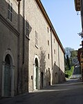
Photo: No machine-readable author provided. Travelvirus~commonswiki assumed (based on copyright claims)., Public domain · Wikimedia Commons
Archaeological site
Archaeological site in Lonato del Garda, Italy
Lonato del Garda (BS), Lombardy
Opening hours and directions are on this page. The full story is on Italian Wikipedia.
Read it in ItalianDistances are as the crow flies, not walking or driving.


Capo di Ponte (BS)

Fornaci romane di Lonato del Garda is in Lonato del Garda, in the province of Brescia (Lombardy), Italy. Address: Via Mantova, 54, Lonato del Garda. GPS coordinates: 45.41598, 10.50730.
According to OpenStreetMap the opening hours are: Sunday: 10:00–17:00. Always check the official website before your visit.
There is an admission charge. Up-to-date prices are on the official website.
Nearby you’ll find: Convento di Santa Maria (2 km away), Palazzo Pastore (2.9 km away), Palazzo del Principe (3 km away).
Data. Wikidata (CC0); opening hours and contacts OpenStreetMap (ODbL).
Photos. Wikimedia Commons, author and licence on every image.
Updated 28 October 2026. All sources and licences