


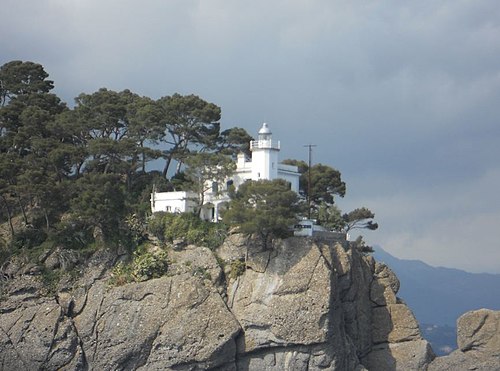
Photo: Alle from milan, made in Italy, CC BY-SA 2.0 · Wikimedia Commons
At a glance
- Type
- Lighthouse
- Period
- Modern era, 1840
- Coordinates
- 44°01′36″ N, 9°50′58″ E
History and description
San Venerio Lighthouse (Italian: Faro di San Venerio) is an active lighthouse on the island of Tino, in the comune of Porto Venere in the Province of La Spezia, Liguria, Italy. Its construction began in 1839, and was completed in 1840. It illuminates and guides the sailors in that part of Ligurian Sea. It is named for Venerius the Hermit, the patron saint of lighthouse keepers.
History
San Venerio Lighthouse is a fortified neoclassical building, despite having undergone many changes over time. Construction of the lighthouse was granted by King Charles Albert of Savoy and was initially fueled by vegetable oil, followed later by coal. In 1884 another tower was built, taller than the original at 30 metres (98 ft) high, and at the top of the lenses an optical filament was added, electrically powered by two steam engines. This system gave too much power to the beam of light, and in 1912 the fuel was replaced with petroleum. The lighthouse was later electrified, and became fully automated in 1985.
The lighthouse is completely controlled and operated by the Marina Militare based in La Spezia.
In the evening, near Lerici (located on the opposite side of the Gulf of La Spezia) or the Cinque Terre the light can be seen flashing across the sea in the darkness.
Text from Wikipedia, the free encyclopedia, under CC BY-SA 4.0. Full article: «San Venerio Lighthouse».
Timeline
- 1840Built
Events and people from Wikidata (CC0).
Photos
Getting there
La Spezia CentraleTrain, nearest
9.9 km as the crow flies
San Venerio Lighthouse
Pozzale1.4 km
Distances are as the crow flies, not walking or driving.
Loading map…
Nearby
See on the mapMore lighthouses in Liguria



Frequently asked questions
Where is San Venerio Lighthouse?
San Venerio Lighthouse is in Porto Venere, in the province of La Spezia (Liguria), Italy. GPS coordinates: 44.02667, 9.84944.
How old is San Venerio Lighthouse?
Wikidata dates it to 1840.
What else is there to see near San Venerio Lighthouse?
Nearby you’ll find: Abbazia di San Venerio (200 m away), Forte Cavour (1.8 km away), Umberto I Fort (2.7 km away).
Sources and licences
Text. Wikipedia, the free encyclopedia (CC BY-SA 4.0).
Data. Wikidata (CC0); opening hours and contacts OpenStreetMap (ODbL).
Photos. Wikimedia Commons, author and licence on every image.
Credits for the 2 photos
- Faro dell'isola del Tino-Flickr — Alle from milan, made in Italy, CC BY-SA 2.0
- Isola del Tino - Panorama — Samuele on English Wikipedia Samuele nella Wikipedia Italiana, Public domain
Updated 28 October 2026. All sources and licences