


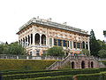

Photo: Stefano Mazzone, CC BY-SA 3.0 · Wikimedia Commons
At a glance
- Type
- Lighthouse
- Period
- Modern era, 1931
- Coordinates
- 44°23′31″ N, 8°57′10″ E
History and description
Punta Vagno Lighthouse (Italian: Faro di Punta Vagno) is an active lighthouse located on the same name Cape at the east entrance of the Port of Genoa, Liguria on the Ligurian Sea.
Description
The lighthouse was built at the end of 19th century, but was activated on October 10, 1931, and consists of a white masonry tapered cylindrical tower, 8 feet (2.4 m) high, with balcony and lantern. The tower was destroyed during World War II and was rebuilt in 1948. The lantern is painted in white, the dome in grey metallic, and is positioned at 26 metres (85 ft) above sea level and emits three long white flashes in a 15 seconds period, visible up to a distance of 16 nautical miles (30 km; 18 mi). The lighthouse is completely automated and operated by the Marina Militare with the identification code number 1575 E.F.
Text from Wikipedia, the free encyclopedia, under CC BY-SA 4.0. Full article: «Punta Vagno Lighthouse».
Timeline
- 1931Built
Events and people from Wikidata (CC0).
Getting there
Genova BrignoleTrain, nearest
1.7 km as the crow flies
Punta Vagno Lighthouse
Porto Antico2.8 km
Aeroporto Internazionale di Genova - Cristoforo Colombo9.0 km
Distances are as the crow flies, not walking or driving.
Loading map…
Nearby
See on the mapMore lighthouses in Liguria




Frequently asked questions
Where is Punta Vagno Lighthouse?
Punta Vagno Lighthouse is in Genoa, in the province of Genova (Liguria), Italy. GPS coordinates: 44.39200, 8.95275.
How old is Punta Vagno Lighthouse?
Wikidata dates it to 1931.
What else is there to see near Punta Vagno Lighthouse?
Nearby you’ll find: Batteria del Vagno (0 m away), Forte San Giuliano (600 m away), Batteria San Giuliano (600 m away).
Sources and licences
Text. Wikipedia, the free encyclopedia (CC BY-SA 4.0).
Data. Wikidata (CC0); opening hours and contacts OpenStreetMap (ODbL).
Photos. Wikimedia Commons, author and licence on every image.
Credits for the 1 photos
- Faro Corso Italia Genova - panoramio — Stefano Mazzone, CC BY-SA 3.0
Updated 28 October 2026. All sources and licences