

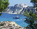


Photo: Giorgio Galeotti, CC BY 4.0 · Wikimedia Commons
At a glance
- Type
- Lighthouse
- Period
- Modern era, 1905
- Materials
- Stone
- Coordinates
- 42°06′24″ N, 15°28′38″ E
Timeline
- 1905Built
Events and people from Wikidata (CC0).
Photos
Getting there
Banchina di Punta Secca San Domino600 m
Distances are as the crow flies, not walking or driving.
Loading map…
Nearby
See on the mapDo you know this place?
We are missing the opening hours and a description. The data comes from open projects: if you add it there, it appears here at the next update.
More lighthouses in Puglia (Apulia)


Frequently asked questions
Where is Punta del Diavolo Lighthouse?
Punta del Diavolo Lighthouse is in Lesina, in the province of Foggia (Puglia (Apulia)), Italy. GPS coordinates: 42.10655, 15.47727.
How old is Punta del Diavolo Lighthouse?
Wikidata dates it to 1905.
What else is there to see near Punta del Diavolo Lighthouse?
Nearby you’ll find: Punta del Diavolo Lighthouse (0 m away), Abbey of Santa Maria a Mare (2.8 km away), Castello dei Badiali (2.8 km away).
Sources and licences
Data. Wikidata (CC0); opening hours and contacts OpenStreetMap (ODbL).
Photos. Wikimedia Commons, author and licence on every image.
Credits for the 5 photos
- San Domino Island's Lighthouse - Tremiti, Foggia, Italy - August 19, 2013 01 (cropped) — Giorgio Galeotti, CC BY 4.0
- Faro di San Domino - Isola di San Domino - Tremiti (FG) Italia - 19 Agosto 2013 - panoramio — Giorgio Galeotti, CC BY 3.0
- San Domino Island's Lighthouse - modern lighthouse — Giorgio Galeotti, CC BY 4.0
- San Domino Island's Lighthouse - Tremiti, Foggia, Italy - August 19, 2013 01 — Giorgio Galeotti, CC BY 4.0
- Tremiti 2006 -San Domino- by-RaBoe 05 — Raboe001, CC BY-SA 2.5
Updated 28 October 2026. All sources and licences