





- Free 1st Sunday
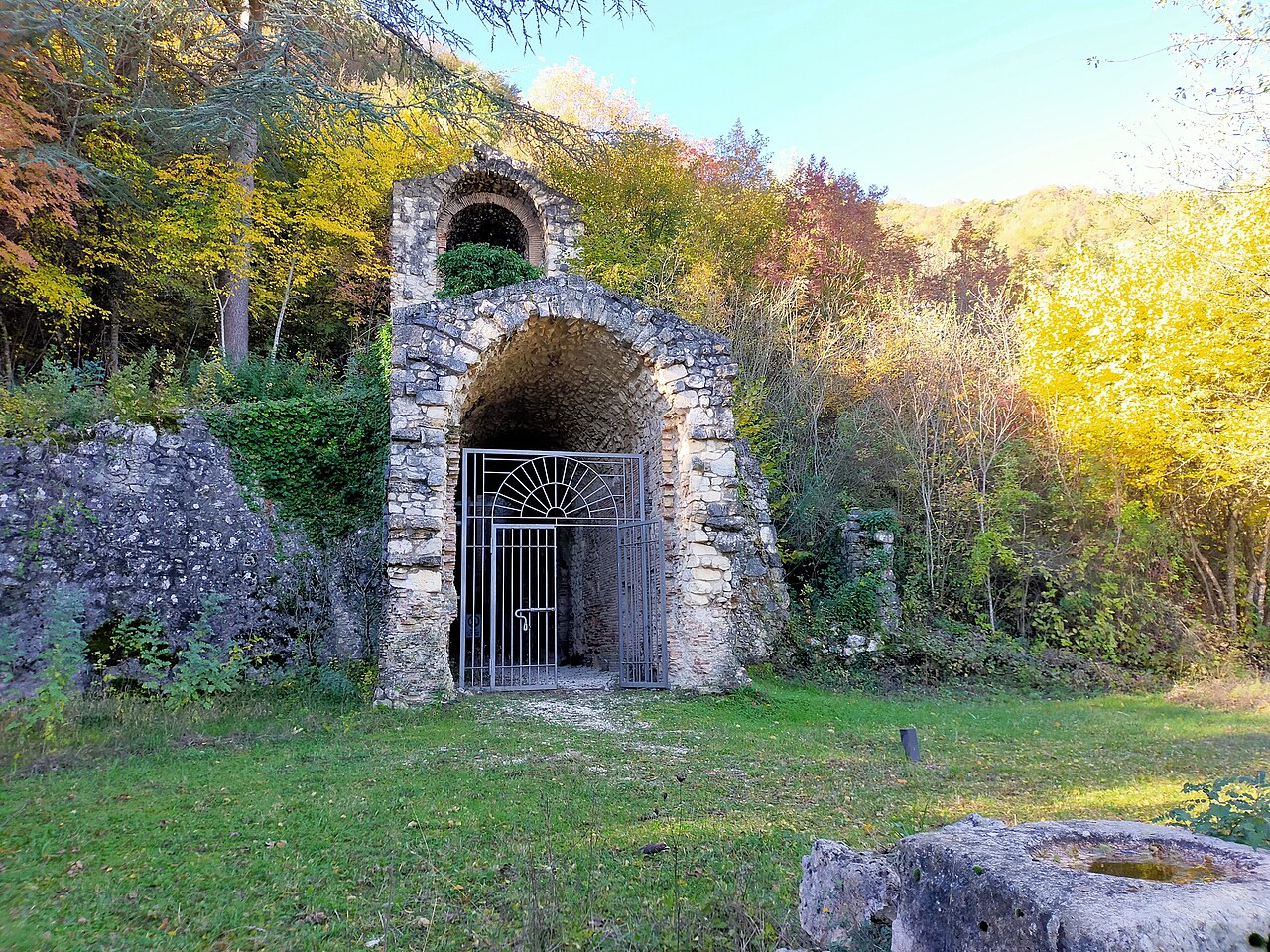
Photo: Marica Massaro, CC BY-SA 4.0 · Wikimedia Commons
Archaeological site
Hydraulic work and archaeological site
Capistrello (AQ), Abruzzo
The Tunnels of Claudius (Italian: Cunicoli di Claudio) consist principally of a 6 km-long tunnel (or emissary) together with several monumental service tunnels which Roman Emperor Claudius had built by 52 AD to partially drain the Fucine Lake in Abruzzo, protecting riparian villages from floods and creating agricultural land. It was a massive engineering project involving 30,000 workmen and slaves who completed it in just 11 years, and considered among the grandest in antiquity. It was the longest tunnel ever built until the inauguration of the Fréjus Rail Tunnel in 1871.
The lake water flowed under Mount Salviano and emptied into the Liri River beneath the present town of Capistrello.
Without regular maintenance the emissary often became clogged, and the lake returned to its original size with regular flooding. It was only in 1854 when Alessandro Torlonia renovated the tunnels mostly following the Roman ones that knowledge of the Roman tunnel was increased whilst also causing the destruction of its superficial features. Original Roman features can be seen in opus reticulatum in the entrance and exit areas.
Lake Fucino was once the 3rd largest lake in Italy and the area is a basin completely enclosed by mountains and with no natural outlet. It is fed by snow meltwater and the seasonal ancient water level variation is estimated to be typically 12 m.
The Marsi, the local inhabitants, had made petitions to Rome to control the unstable level of the lake which very often flooded villages because of the frequent cloggings of the only natural swallow-hole at Petogna near Luco dei Marsi. In summer because of the receding waters, the lands surrounding the inhabited areas often became marshy causing serious health problems due to malaria.
The first plan to drain the lake was of Julius Caesar (r. 49-44 BC) but he died before it could be advanced.
In 41 AD Emperor Claudius resumed the ambitious plan and, thanks to substantial public financing, entrusted a Roman enterprise with the works. The easiest plan was to dig the shortest tunnel through the low Cesolino hill and into the Salto River and eventually into the Tiber. This was discarded because it would be a flood threat to Rome. The second, more difficult, plan was therefore adopted with a longer, deeper tunnel to lead the water into the Liri River
The aim was to only regulate the water level and not drain the lake completely. The tunnel had to be designed to be the shortest compatible with a very shallow slope and in a compass direction that ensured it entered the Liri river at a level lower than the lake, a remarkable feat considering the instruments of the time. Once the direction was decided, the required inclination then determined the location of the tunnel ends.
The emissary has a variable cross-section of 5 to 10 m2 (54 to 108 sq ft), an average flow rate of 9.1 m3/s (320 cu ft/s) and an average gradient of 1.5 m/km (7.9 ft/mi).
The cunicola: the secondary service tunnels and wells. …
Text from Wikipedia, the free encyclopedia, under CC BY-SA 4.0. Full article: «Tunnels of Claudius».
Distances are as the crow flies, not walking or driving.


Tunnels of Claudius is in Capistrello, in the province of L'Aquila (Abruzzo), Italy. GPS coordinates: 41.98853, 13.43339.
Nearby you’ll find: Grotta Afra (900 m away), Grotta di Ciccio Felice (1.2 km away), Lucus Angitiae (3 km away).
Text. Wikipedia, the free encyclopedia (CC BY-SA 4.0).
Data. Wikidata (CC0); opening hours and contacts OpenStreetMap (ODbL).
Photos. Wikimedia Commons, author and licence on every image.
Updated 28 October 2026. All sources and licences