


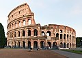


Abbey / Monastery, Rome (RM)
41°53′35″ N, 12°29′34″ E
No photo on Wikimedia Commons yet
Abbey / Monastery
Casa Provinciale delle Piccole Sorelle dei Poveri
- Within the UNESCO World Heritage Site “Historic Centre of Rome, the Properties of the Holy See in that City Enjoying Extraterritorial Rights and San Paolo Fuori le Mura”
At a glance
- Type
- Abbey / Monastery
- Coordinates
- 41°53′35″ N, 12°29′34″ E
About
No English description yet
Opening hours and directions are on this page. The full story is on Italian Wikipedia.
Read it in ItalianGetting there
Roma TerminiTrain, nearest
1.2 km as the crow flies
Casa Provinciale delle Piccole Sorelle dei Poveri
Aeroporto di Roma-Ciampino13.3 km
Distances are as the crow flies, not walking or driving.
Loading map…
Nearby
See on the mapDo you know this place?
We are missing the opening hours, a description and photos. The data comes from open projects: if you add it there, it appears here at the next update.
More abbeys and monasteries in Lazio


- Free 1st Sunday


Frequently asked questions
Where is Casa Provinciale delle Piccole Sorelle dei Poveri?
Casa Provinciale delle Piccole Sorelle dei Poveri is in Rome, in the province of Roma (Lazio), Italy. GPS coordinates: 41.89311, 12.49264.
What else is there to see near Casa Provinciale delle Piccole Sorelle dei Poveri?
Nearby you’ll find: Baths of Titus (100 m away), Compitum Acili (300 m away), Temple of Tellus (300 m away).
Sources and licences
Data. Wikidata (CC0); opening hours and contacts OpenStreetMap (ODbL).
Photos. Wikimedia Commons, author and licence on every image.
Credits for the 1 photos
- Piazza di San Pietro in Vincoli - panoramio (1) — Mister No, CC BY 3.0
Updated 28 October 2026. All sources and licences