


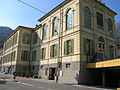


- Most beautiful villages
Photo: Patafisik, CC BY-SA 4.0 · Wikimedia Commons
Historic village
Italian municipality in the Aosta Valley
Bard is a village and comune (municipality) in the Aosta Valley region of northwestern Italy. It is part of the Unité des communes valdôtaines du Mont-Rose and has a population of 99. It is one of I Borghi più belli d'Italia ("The most beautiful villages of Italy").
Fort Bard (Italian: Forte di Bard; French: Fort de Bard) is a fortified complex built in the 19th century by the House of Savoy on a rocky prominence above the town. After many years of neglect, it has been completely restored. In 2006 it reopened to tourists as the home for the Museum of the Alps. The fort also has art exhibitions. In the summer, the main courtyard is used to host musical and theatrical performances.
Bard lies at the centre of a deep, narrow gorge at the head of the Aosta Valley. This strategic point has been inhabited since the Neolithic period as archaeologists have found several large engraved stones around the area. It later became a major route between Celtic Gaul and the Roman world of the Italian peninsula.
Today the town has many buildings dating back to the 16th century. These include the Bishop's House and the House of the Sun Dial. The Dora Baltea is also crossed by a medieval stone bridge
Fort Bard, which protects the pass, is built on the site of many earlier fortifications. In May 1800, it halted an entire French army launching a surprise attack on Northern Italy. It eventually fell to the division of French general Joseph Chabran on 1 June 1800.
Text from Wikipedia, the free encyclopedia, under CC BY-SA 4.0. Full article: «Bard, Aosta Valley».
Distances are as the crow flies, not walking or driving.

Bard, Aosta Valley is in Bard, Aosta Valley (Aosta Valley), Italy. GPS coordinates: 45.61667, 7.75000.
Nearby you’ll find: Fort Bard (1 km away), Museum of the Alps (1 km away), Marelli Palace (1.1 km away).
Text. Wikipedia, the free encyclopedia (CC BY-SA 4.0).
Data. Wikidata (CC0); opening hours and contacts OpenStreetMap (ODbL).
Photos. Wikimedia Commons, author and licence on every image.
Updated 28 October 2026. All sources and licences