Saved
Prehistoric archaeological site
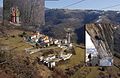
Original photo1 of 5 photos

Photo: FABIO AMBROSINI, CC BY-SA 4.0 · Wikimedia Commons

Archaeological site

Prehistoric archaeological site

Prehistoric archaeological site in Lusiana Conco, Italy

Lusiana Conco (VI), Veneto

Directions

At a glance

Protection
Italian national heritage
Coordinates
45°47′15″ N, 11°34′10″ E
Address
Via Piazza, 36046 Lusiana Conco

Photos

Getting there

Carpanè - ValstagnaTrain, nearest
10.7 km as the crow flies
Prehistoric archaeological siteVia Piazza, 36046 Lusiana Conco

Distances are as the crow flies, not walking or driving.

Loading map…

Do you know this place?

We are missing the opening hours and a description. The data comes from open projects: if you add it there, it appears here at the next update.

More archaeological sites in Veneto

  • UNESCO
Archaeological site, 30 AD

Verona Arena

Verona (VR)

Opening hours
  • Free 1st Sunday
Archaeological site

Altinum

Quarto d'Altino (VE)

See all archaeological sites in Veneto

Things to see in Lusiana Conco: 9 historic places

Frequently asked questions

Where is Prehistoric archaeological site?

Prehistoric archaeological site is in Lusiana Conco, in the province of Vicenza (Veneto), Italy. Address: Via Piazza, 36046 Lusiana Conco. GPS coordinates: 45.78751, 11.56949.

What else is there to see near Prehistoric archaeological site?

Nearby you’ll find: Parco del Sojo (2.2 km away), Villa Piovene (5.2 km away), Villa Godi (5.3 km away).

Sources and licences

Data. Wikidata (CC0); opening hours and contacts OpenStreetMap (ODbL).

Photos. Wikimedia Commons, author and licence on every image.

Credits for the 5 photos
  1. Villaggio monte corgnon 2 — FABIO AMBROSINI, CC BY-SA 4.0
  2. Villaggio preistorico di monte Corgnon, Lusiana 2023 abc1 — Una tantum, CC BY-SA 4.0
  3. Villaggio monte corgnon 1 — FABIO AMBROSINI, CC BY-SA 4.0
  4. Buca, Monte Corgnon — Una tantum, CC BY-SA 4.0
  5. Monte Corgnon — Una tantum, CC BY-SA 4.0

Updated 28 October 2026. All sources and licences

Spotted a mistake? Fix it on OpenStreetMap