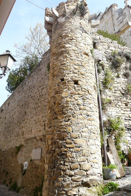






Photo: Davide Papalini, CC BY-SA 2.5 · Wikimedia Commons
At a glance
- Type
- Fortress / Tower
- Period
- Middle Ages, 15th century
- Protection
- Italian national heritage
- Coordinates
- 43°51′48″ N, 7°52′08″ E
- Address
- Via Spirito Santo, Castellaro (IM)
Timeline
- 15th centuryBuilt
Events and people from Wikidata (CC0).
Getting there
Taggia-ArmaTrain, nearest
2.3 km as the crow flies
Torretta merlataVia Spirito Santo, Castellaro (IM)
Distances are as the crow flies, not walking or driving.
Loading map…
Nearby
See on the mapDo you know this place?
We are missing the opening hours and a description. The data comes from open projects: if you add it there, it appears here at the next update.
More fortresses and towers in Liguria


Frequently asked questions
Where is Torretta merlata?
Torretta merlata is in Castellaro, in the province of Imperia (Liguria), Italy. Address: Via Spirito Santo, Castellaro (IM). GPS coordinates: 43.86322, 7.86888.
How old is Torretta merlata?
Wikidata dates it to the 15th century.
What else is there to see near Torretta merlata?
Nearby you’ll find: Nostra Signora del Canneto (1.4 km away), Chiesa dei Cappuccini (1.4 km away), Saint Dominic monastery (Taggia) (1.5 km away).
Sources and licences
Data. Wikidata (CC0); opening hours and contacts OpenStreetMap (ODbL).
Photos. Wikimedia Commons, author and licence on every image.
Credits for the 1 photos
- Castellaro-P1010102 — Davide Papalini, CC BY-SA 2.5
Updated 28 October 2026. All sources and licences