At a glance
- Coordinates
- 40°40′10″ N, 8°36′46″ E
Getting there
2.6 km as the crow flies
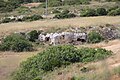
Strada romana di Sos Bajolos
Aeroporto di Alghero-Fertilia27.5 km
Distances are as the crow flies, not walking or driving.
Do you know this place?
We are missing the opening hours and a description. The data comes from open projects: if you add it there, it appears here at the next update.
More archaeological sites in Sardinia
Archaeological site Barumini (VS)
Opening hours
Archaeological site Pula (CA)
Opening hours
Archaeological site Sassari (SS)
Opening hours
Archaeological site Paulilatino (OR)
Opening hours
Archaeological site Orune (NU)
Opening hours
Archaeological site Carbonia (CI)
Opening hours
See all archaeological sites in Sardinia
Things to see in Cargeghe: 5 historic places
Frequently asked questions
Where is Strada romana di Sos Bajolos?
Strada romana di Sos Bajolos is in Cargeghe, in the province of Sassari (Sardinia), Italy. GPS coordinates: 40.66947, 8.61287.
What else is there to see near Strada romana di Sos Bajolos?
Nearby you’ll find: Necropoli di Noeddale (1.7 km away), Necropolis of S'Elighe Entosu (2 km away), Necropolis of Pedras Serradas (2.3 km away).
Sources and licences
Data. Wikidata (CC0); opening hours and contacts OpenStreetMap (ODbL).
Photos. Wikimedia Commons, author and licence on every image.
Credits for the 9 photos
- Cargeghe, strada romana di Sos Bajolos (01) — Gianni Careddu, CC BY-SA 4.0
- Cargeghe, strada romana di Sos Bajolos (02) — Gianni Careddu, CC BY-SA 4.0
- Strada Sos Baiolos (200 a.C.) — Giuseppe Ruiu, CC BY-SA 3.0
- Campomela (01) — Gianni Careddu, CC BY-SA 4.0
- Cargeghe - Crastu Longu (01) — Gianni Careddu, CC BY-SA 3.0
- Cargeghe - Zona industriale (01) — Gianni Careddu, CC BY-SA 4.0
- Cargeghe sotto la neve — Giuseppe Ruiu, CC BY-SA 3.0
- Cargeghe-Codrongianos, zona industriale di Campomela (01) — Gianni Careddu, CC BY-SA 4.0
- Casa parrocchiale di Cargeghe — Giuseppe Ruiu, CC BY-SA 4.0
Updated 28 October 2026. All sources and licences
Spotted a mistake? Fix it on OpenStreetMap