At a glance
- UNESCO World Heritage
- Prehistoric Pile Dwellings around the Alps
- Coordinates
- 45°10′46″ N, 11°12′40″ E
About
No English description yet
Opening hours and directions are on this page. The full story is on Italian Wikipedia.
Read it in ItalianGetting there
1.8 km as the crow flies
Tombola archaeological site
Aeroporto Valerio Catullo di Verona-Villafranca35.0 km
Distances are as the crow flies, not walking or driving.
 Villa Catterinetti, Franco, BertelèHistoric villa / palace, Cerea3.9 km
 Villa DionisiHistoric villa / palace, Cerea5.0 km
 Walls of LegnagoFortress / Tower, Legnago7.4 km
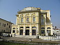 Teatro SalieriHistoric theatre, Legnago7.7 km
 Villa MandellaHistoric villa / palace, Isola Rizza12.6 km
- Palazzina MondadoriMuseum, Ostiglia13.7 km
- Museo della giostra e dello spettacolo popolareMuseum, Bergantino13.7 km
 Villa Gonzaga-ZaniHistoric villa / palace, Villimpenta14.5 km
More archaeological sites in Veneto
Archaeological site, 30 AD Verona (VR)
Opening hours
Archaeological site Verona (VR)
Opening hours
Archaeological site Quarto d'Altino (VE)
Archaeological site Fumane (VR)
Archaeological site Verona (VR)
Opening hoursFree entry
Archaeological site Padua (PD)
See all archaeological sites in Veneto
Things to see in Cerea: 4 historic places
Frequently asked questions
Where is Tombola archaeological site?
Tombola archaeological site is in Cerea, in the province of Verona (Veneto), Italy. GPS coordinates: 45.17954, 11.21125.
What else is there to see near Tombola archaeological site?
Nearby you’ll find: Villa Catterinetti, Franco, Bertelè (3.9 km away), Villa Dionisi (5 km away), Walls of Legnago (7.4 km away).


