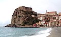


Archaeological site, Scilla (RC)
38°15′21″ N, 15°42′53″ E
No photo on Wikimedia Commons yet
Archaeological site
Scyllaeum
Ancient town and fortress on Scyllaeum promontory, Italy
At a glance
- Type
- Archaeological site
- Coordinates
- 38°15′21″ N, 15°42′53″ E
About
Scyllaeum or Scylaeum (Greek: τὸ Σκύλλαιον or Σκύλαιον) was a promontory, and ancient town or fortress, on the west coast of Bruttium (modern Calabria), about 25 km north of Rhegium (Reggio di Calabria), and almost exactly at the entrance of the Sicilian strait.
The promontory is well described by Strabo as a projecting rocky headland, jutting out boldly into the sea, and united to the mainland by a narrow neck or isthmus, so as to form two small but well sheltered bays, one on each side. There can be no doubt that this rocky promontory was the one which became the subject of so many fables, and which was represented by Homer and other poets as the abode of the monster Scylla. But the dangers of the rock of Scylla were far more fabulous than those of its neighbor Charybdis, and it is difficult to understand how, even in the infancy of navigation, it could have offered any obstacle more formidable than a hundred other headlands whose names are unknown to fame.
Text from Wikipedia, the free encyclopedia, under CC BY-SA 4.0. Full article: «Scyllaeum».
Getting there
ScillaTrain, nearest
600 m as the crow flies
Scyllaeum
Port8.0 km
Aeroporto di Reggio Calabria - Tito Minniti21.2 km
Distances are as the crow flies, not walking or driving.
Loading map…
The town
 Things to see in Scilla4,513 inhabitants, 113 m above sea level. 3 historic places in the town.PhotoCirimbillo, CC BY 3.03 places
Nearby
See on the mapDo you know this place?
We are missing the opening hours and photos. The data comes from open projects: if you add it there, it appears here at the next update.
More archaeological sites in Calabria


Frequently asked questions
Where is Scyllaeum?
Scyllaeum is in Scilla, in the province of Reggio Calabria (Calabria), Italy. GPS coordinates: 38.25590, 15.71460.
What else is there to see near Scyllaeum?
Nearby you’ll find: Castello Ruffo di Scilla (0 m away), Scilla Lighthouse (100 m away), Torre Cavallo (3.2 km away).
Sources and licences
Text. Wikipedia, the free encyclopedia (CC BY-SA 4.0).
Data. Wikidata (CC0); opening hours and contacts OpenStreetMap (ODbL).
Photos. Wikimedia Commons, author and licence on every image.
Credits for the 1 photos
- Mundus subterraneus, in XII libros digestus (15669693732) — Kircher, Athanasius, Public domain
Updated 28 October 2026. All sources and licences