



- Most beautiful villages
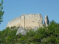
Photo: Zitumassin, CC BY 3.0 · Wikimedia Commons
Historic village
Italian comune
Pretoro (locally Pretèure) is a town of about 1,100 inhabitants situated in Majella National Park, in the province of Chieti, Abruzzo, southern Italy. It is located on a steep hillside on the eastern side of the Maiella mountains. Its proximity to Passo Lanciano-La Majelletta ski area, guarantees the availability of winter sports, while the town is also only 20 minutes by car from the Adriatic Sea. It is one of I Borghi più belli d'Italia ("The most beautiful villages of Italy").
The area in which Pretoro is located has been occupied since prehistoric times; remains from that period have been found here, as well as inscriptions in Latin from the Roman era. The first documented mention of the town is in a 12th-century record. Pretoro's name may derive from the word "preta", an earlier form of the word "pietra" or stone. The town stands on a rocky landscape that does not lend itself to farming. Because the town is surrounded by beech-forest, the people of Pretoro have specialized over the centuries in woodcarving.
Pretoro is composed of a cluster of stone buildings which climb the steep mountainside; the oldest part of the town is at the highest point, while down below is a newer section.
The 13th century Sanctuary of the Madonna della Mazza is located a little above the town. This was a hermitage built by Benedictine and Cistercian monks from Santa Maria Arabona at Manoppello. A work of art is the 16th century sculpture of the Pietà preserved in the church of San Nicola.
Within the town's territory is a nature preserve, the Riserva Naturale Valle del Foro.
Text from Wikipedia, the free encyclopedia, under CC BY-SA 4.0. Full article: «Pretoro».
Distances are as the crow flies, not walking or driving.


Pretoro is in Pretoro, in the province of Chieti (Abruzzo), Italy. Address: Comune, Via dei Mulini, 3/a. GPS coordinates: 42.21630, 14.14304.
Nearby you’ll find: Necropoli del Crocifisso (0 m away), Museo della ceramica (3.7 km away), San Liberatore a Maiella (4.1 km away).
Text. Wikipedia, the free encyclopedia (CC BY-SA 4.0).
Data. Wikidata (CC0); opening hours and contacts OpenStreetMap (ODbL).
Photos. Wikimedia Commons, author and licence on every image.
Updated 28 October 2026. All sources and licences