


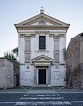

Photo: Ardeatino, CC BY 4.0 · Wikimedia Commons
Fortress / Tower, 5th century
Porta Latina
Gate in the Aurelian Walls of ancient Rome
At a glance
- Type
- Fortress / Tower
- Period
- Antiquity, 5th century
- Founder
- Honorius
- Materials
- Travertine
- Coordinates
- 41°52′35″ N, 12°30′09″ E
History and description
The Porta Latina (Latin - Latin Gate) is a single-arched gate in the Aurelian Walls of ancient Rome.
History
It marked the Rome end of the Via Latina and gives its name to the church of San Giovanni a Porta Latina. Most of the present structure dates to Honorius, including the arch's voussoirs (though they are often wrongly attributed to a 6th-century restoration by Belisarius, due to a cross and circle sculpted on the inner keystone, and the Chi Rho between Α and Ω sculpted on the outer keystone). The gate retained its name throughout the Middle Ages. Also nearby are the oratory of San Giovanni in Oleo and the pagan Columbarium of Pomponius Hylas.
The gate's single arch is built of irregular blocks of travertine, with a row of five windows above on the outside, and a sixth in brick, at the south end, surmounted by stone battlements. The arch is flanked by two semi-circular towers of brick-faced concrete (almost entirely rebuilt, probably in the 6th century), which do not rise above the top of the central section. The north tower rests on masonry foundations that may have belonged to a tomb.
Text from Wikipedia, the free encyclopedia, under CC BY-SA 4.0. Full article: «Porta Latina».
Timeline
- 5th centuryBuilt
People
Events and people from Wikidata (CC0).
Photos
Getting there
Roma OstienseTrain, nearest
1.4 km as the crow flies
Porta Latina
Aeroporto di Roma-Ciampino11.4 km
Distances are as the crow flies, not walking or driving.
Loading map…
Nearby
See on the mapMore fortresses and towers in Lazio


- UNESCO


Frequently asked questions
Where is Porta Latina?
Porta Latina is in Rome, in the province of Roma (Lazio), Italy. GPS coordinates: 41.87650, 12.50250.
How old is Porta Latina?
Wikidata dates it to the 5th century.
What else is there to see near Porta Latina?
Nearby you’ll find: Tomb of the Scipios (200 m away), Arch of Drusus (300 m away), Porta San Sebastiano (300 m away).
Sources and licences
Text. Wikipedia, the free encyclopedia (CC BY-SA 4.0).
Data. Wikidata (CC0); opening hours and contacts OpenStreetMap (ODbL).
Photos. Wikimedia Commons, author and licence on every image.
Credits for the 3 photos
- Door Latina - external side — Ardeatino, CC BY 4.0
- Porta Latina, Parco Egerio, Roma, Italia Sep 01, 2020 01-08-26 PM — Dieterdreist, CC BY-SA 4.0
- Roma - Porta Latina - 2025-09-07 14-46-27 001 — Tommasopaiano, CC BY-SA 4.0
Updated 28 October 2026. All sources and licences