

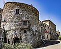


Photo: giampiero58, CC BY-SA 4.0 · Wikimedia Commons
At a glance
- Type
- Archaeological site
- Protection
- Italian national heritage
- Coordinates
- 42°35′17″ N, 11°35′01″ E
About
Poggio Buco is an Etruscan archaeological site in the municipality of Pitigliano, in the province of Grosseto, Tuscany, Italy. The name refers to both the settlement on the Pianoro delle Sparne plateau in the Fiora valley and the nearby necropolis. The site was once associated with the lost city of Statonia, but this identification has been rejected.
Excavations began in 1959 at the necropolis and in 1980 at the settlement. The site developed in several phases, from the late Bronze Age to the late Hellenistic period. Early burials show Proto-Villanovan cultural elements, while later phases include fortifications, buildings, and architectural decorations with zoomorphic and mythological reliefs. Poggio Buco may have functioned as a secondary aristocratic residence of Vulci, with possible ritual elements, although its exact role remains uncertain.
Text from Wikipedia, the free encyclopedia, under CC BY-SA 4.0. Full article: «Poggio Buco».
Photos
Getting there
Our data shows no stations, stops or car parks nearby. Check how to get there before you set out.
Loading map…
Nearby
See on the mapMore archaeological sites in Tuscany


- Free 1st Sunday
Frequently asked questions
Where is Poggio Buco?
Poggio Buco is in Pitigliano, in the province of Grosseto (Tuscany), Italy. GPS coordinates: 42.58814, 11.58372.
What else is there to see near Poggio Buco?
Nearby you’ll find: Necropoli di Poggio Buco (100 m away), Necropoli di Ponte San Pietro (5.4 km away), Walls of Manciano (5.5 km away).
Sources and licences
Text. Wikipedia, the free encyclopedia (CC BY-SA 4.0).
Data. Wikidata (CC0); opening hours and contacts OpenStreetMap (ODbL).
Photos. Wikimedia Commons, author and licence on every image.
Credits for the 9 photos
- Necropoli di Poggio Buco — giampiero58, CC BY-SA 4.0
- Affibbiagli di cinturone, in bronzo, da poggio buco, 710-600 ac ca — Sailko, CC BY 3.0
- Alabastra a corpo ovoide, 610-500 ac ca., da poggio buco — Sailko, CC BY 3.0
- Balsamari a forma di cerbiatto e di cigno, 560-540 ac ca., da poggio buco — Sailko, CC BY 3.0
- Calice di bucchero da poggio buco, 550-500 ac. circa 01 — sailko, CC BY-SA 3.0
- Calice in bucchero su alto piede con decorazioni a rilievo, da poggio buco (GR), 550-525 ac ca. — Sailko, CC BY 3.0
- Ciclo dei rosoni, kilixes (coppe), 575-550 ac ca., da poggio buco — Sailko, CC BY 3.0
- Ciclo di codros, gruppo di magliano e gruppo a maschera umana, kylixes (coppe), da poggio buco, 525-500 ac ca — Sailko, CC BY 3.0
- Cineriario biconico su piede, dalla necropoli di poggio buco, 750-725 ca ca — Sailko, CC BY 3.0
Updated 28 October 2026. All sources and licences