


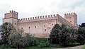

Photo: Lucia Carfagna, CC BY-SA 3.0 · Wikimedia Commons
Archaeological site
Archaeological Park of Urbs Salvia
Archaeological site in Urbisaglia, Italy
Urbisaglia (MC), Marche
At a glance
- Type
- Archaeological site
- Protection
- Italian national heritage
- Coordinates
- 43°12′00″ N, 13°23′10″ E
- Address
- Via del Sacrario 5, 62010 Urbisaglia
History and description
The Archaeological Park of Urbs Salvia is situated in the comune of Urbisaglia (Province of Macerata), in the Marches, Italy. It is the largest archaeological park in the region.
History
The city was founded as a colonia during the 2nd century BC. It was in the Roman province of Picenum and on the via Salaria Gallica. Its monuments were largely built under Augustus and Tiberius.. It was later the birthplace of some leading figures of the Roman Empire, such as the consul Gaius Fufius Geminus and Lucius Flavius Silva Nonius Bassus.
Urbs Salvia was sacked by the Visigoths in 408–10 AD, and suffered destruction over the years from earthquakes and plundering.
Archaeological Park
The Archaeological Park of Urbs Salvia is exceptional for the ease with which the overall building plan can be deciphered. The itinerary starts at the Archaeological Museum which houses, among other things, epigraphs, statues and portraits that were excavated in Urbisaglia from the middle of the 18th century onwards.
Just outside the medieval city walls, on the highest point of the site, you can find the large reservoir collecting and cleaning the water coming from the Roman Aqueduct of Urbs Salvia. It was formed by an underground vaulted conduit with lateral walls made of bricks (opus latericium). The ancient aqueduct ran under the top of this hill and was about 1.5 km long. It had a gentle and constant slope so that it could carry water from a spring situated at the opposite side of the present-day Urbisaglia into this structure.
The cisterns consist of two barrel vaulted tunnels connected at both ends, with internal walls covered by hydraulic mortar. The whole structure was built in opus caementicium (Roman concrete).
Each tunnel was about 51 m long, 2.90 m wide and 4.10 m high and had a capacity of about 1,000 cubic metres of water.
The reservoir provided the whole town with spring water and it was situated in the highest area inside Urbs Salvia so that it could be powered only by gravity. In the reservoir are still visible:
the water outlet: the opening through which water was distributed to the town. The pipes (fistulae) were made of lead;
the ventilation shafts (lumina): a series of openings in the vault for air exchange, check of level and quality of water and periodical maintenance (manual cleaning of the internal walls);
the water inlet: whence water flowed inside. It is formed by one of the ends of the aqueduct and shows a very thick layer of water deposit (calcium carbonate);
traces of the planks utilized to build the vaults are still visible at some parts. …
Text from Wikipedia, the free encyclopedia, under CC BY-SA 4.0. Full article: «Archaeological Park of Urbs Salvia».
Photos
Getting there
PollenzaTrain, nearest
4.8 km as the crow flies
Archaeological Park of Urbs SalviaVia del Sacrario 5, 62010 Urbisaglia
Distances are as the crow flies, not walking or driving.
Loading map…
Nearby
See on the mapMore archaeological sites in Marche


Frequently asked questions
Where is Archaeological Park of Urbs Salvia?
Archaeological Park of Urbs Salvia is in Urbisaglia, in the province of Macerata (Marche), Italy. Address: Via del Sacrario 5, 62010 Urbisaglia. GPS coordinates: 43.20005, 13.38603.
What are the opening hours of Archaeological Park of Urbs Salvia?
According to OpenStreetMap the opening hours are: Mar 1- Jun 14, Sep 16-Oct 31: Sa, Su, PH 10:00-13:00,15:00-18:00; Jun 15-Sep 15: Mo-Su 10:00-13:00,15:00-19:00; Nov 1-Feb 28: Sa, Su, PH 10:00-13:00,14:30-16:30. Always check the official website before your visit.
Can I visit Archaeological Park of Urbs Salvia for free?
Yes: entry is free on the first Sunday of every month, under the Italian “Domenica al museo” scheme.
What else is there to see near Archaeological Park of Urbs Salvia?
Nearby you’ll find: National Archaeological Museum of Urbisaglia (800 m away), Rocca di Urbisaglia (900 m away), Chiaravalle Abbey, Fiastra (2.9 km away).
Sources and licences
Text. Wikipedia, the free encyclopedia (CC BY-SA 4.0).
Data. Wikidata (CC0); opening hours and contacts OpenStreetMap (ODbL).
Photos. Wikimedia Commons, author and licence on every image.
Credits for the 2 photos
- Mura di Urbs Salvia-lato nord — Lucia Carfagna, CC BY-SA 3.0
- Urbisaglia - Parco archeologico di Urbs Salvia - 2024-09-22 12-57-07 001 — Paulacastelli, CC BY-SA 4.0
Updated 28 October 2026. All sources and licences