


- UNESCO
- Free 1st Sunday
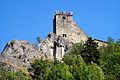
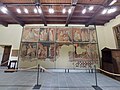
Photo: Pivari.com, CC BY-SA 4.0 · Wikimedia Commons
Abbey / Monastery, 17th century
Town hall in Fanano, Italy
Fanano (MO), Emilia-Romagna
Events and people from Wikidata (CC0).
Address
via Vittorio Veneto ‒ Fanano (MO)
Our data shows no stations, stops or car parks nearby. Check how to get there before you set out.
We are missing the opening hours and a description. The data comes from open projects: if you add it there, it appears here at the next update.


Town hall of Fanano is in Fanano, in the province of Modena (Emilia-Romagna), Italy. Address: via Vittorio Veneto ‒ Fanano (MO). GPS coordinates: 44.20741, 10.79517.
Wikidata dates it to the 17th century.
Nearby you’ll find: Castello di Sestola (3.2 km away), Museums of Sestola's Castle (3.3 km away), Castello di Montecuccolo (11.8 km away).
Data. Wikidata (CC0); opening hours and contacts OpenStreetMap (ODbL).
Photos. Wikimedia Commons, author and licence on every image.
Updated 28 October 2026. All sources and licences