At a glance
- Coordinates
- 40°12′60″ N, 16°40′51″ E
Getting there
Policoro-TursiTrain, nearest
1.3 km as the crow flies
Distances are as the crow flies, not walking or driving.
Do you know this place?
We are missing the opening hours and a description. The data comes from open projects: if you add it there, it appears here at the next update.
More historic villas and palaces in Basilicata
Historic villa / palace Matera (MT)
Opening hours
Historic villa / palace Maratea (PZ)
Historic villa / palace Melfi (PZ)
Historic villa / palace, 1779 Matera (MT)
Historic villa / palace Potenza (PZ)
Historic villa / palace, 1448 Matera (MT)
See all historic villas and palaces in Basilicata
Things to see in Policoro: 7 historic places
Frequently asked questions
Where is Palazzo Baronale?
Palazzo Baronale is in Policoro, in the province of Matera (Basilicata), Italy. GPS coordinates: 40.21666, 16.68078.
What else is there to see near Palazzo Baronale?
Nearby you’ll find: Heraclea Lucania (500 m away), Museo nazionale della Siritide (Policoro) (900 m away), Castello di San Basilio (11.9 km away).
Sources and licences
Data. Wikidata (CC0); opening hours and contacts OpenStreetMap (ODbL).
Photos. Wikimedia Commons, author and licence on every image.
Credits for the 9 photos
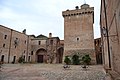
- Facciata esterna Palazzo Baronale — Laura Di Vincenzo, CC BY-SA 4.0
- Passaggio del Palazzo Baronale di Policoro — Laura Di Vincenzo, CC BY-SA 4.0
- Castello Baronale Policoro - esterno — Marycarliter, CC BY-SA 4.0
- Castello Baronale Policoro - interno — Marycarliter, CC BY-SA 4.0
- Facciata della Cappella all'interno del Palazzo Baronale — Laura Di Vincenzo, CC BY-SA 4.0
- Palazzo Baronale particolari — Laura Di Vincenzo, CC BY-SA 4.0
- CASTELLO BARONALE — Magnolia77, CC BY-SA 4.0
- Palazzo Berlingieri particolari della corte — Laura Di Vincenzo, CC BY-SA 4.0
- Palazzo Berlingieri particolari — Laura Di Vincenzo, CC BY-SA 4.0
Updated 28 October 2026. All sources and licences
Spotted a mistake? Fix it on OpenStreetMap