




- UNESCO
Photo: Aschy, CC BY 3.0 · Wikimedia Commons
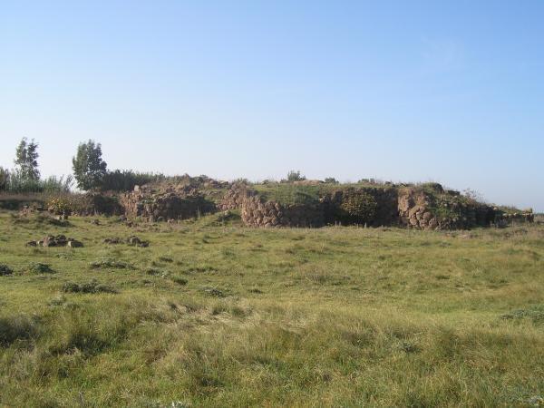
The Nuraghe S'Urachi or S'Uraki is an archaeological site of the Bronze Age period located in the municipality of San Vero Milis, in the province of Oristano, Sardinia, Italy.
Situated in an alluvial plain near the town, it is a complex nuraghe, protected by seven visible towers, linked together by an antemural, and by three other probable towers that would hide below the old former provincial road 10.
Around it there was a village of huts. From the area of the nuraghe comes the famous bronze candelabra of Cypriot type currently exposed to the National Archaeological Museum of Cagliari.
Text from Wikipedia, the free encyclopedia, under CC BY-SA 4.0. Full article: «Nuraghe S'Urachi».
Distances are as the crow flies, not walking or driving.


Nuraghe S'Urachi is in San Vero Milis, in the province of Oristano (Sardinia), Italy. GPS coordinates: 40.01544, 8.58246.
Nearby you’ll find: Palazzo Boyl (5.9 km away), Museo civico di Cabras (10.1 km away), Castello di Casa di Regno (10.6 km away).
Text. Wikipedia, the free encyclopedia (CC BY-SA 4.0).
Data. Wikidata (CC0); opening hours and contacts OpenStreetMap (ODbL).
Photos. Wikimedia Commons, author and licence on every image.
Updated 28 October 2026. All sources and licences