Saved
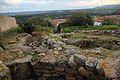
Nuraghe Chessedu
Original photo1 of 3 photos

Photo: Gianni Careddu, CC BY-SA 4.0 · Wikimedia Commons

Archaeological site

Nuraghe Chessedu

Uri (SS), Sardinia

Directions

At a glance

Coordinates
40°36′38″ N, 8°28′04″ E

Photos

Getting there

ArconeTrain, nearest
8.6 km as the crow flies
Nuraghe Chessedu
Aeroporto di Alghero-Fertilia15.1 km

Distances are as the crow flies, not walking or driving.

Loading map…

Do you know this place?

We are missing the opening hours and a description. The data comes from open projects: if you add it there, it appears here at the next update.

More archaeological sites in Sardinia

Archaeological site

Nora

Pula (CA)

Opening hours
  • Free 1st Sunday
Archaeological site

Monte d'Accoddi

Sassari (SS)

Opening hours
Archaeological site

Monte Sirai

Carbonia (CI)

Opening hours

See all archaeological sites in Sardinia

Things to see in Uri: 14 historic places

Frequently asked questions

Where is Nuraghe Chessedu?

Nuraghe Chessedu is in Uri, in the province of Sassari (Sardinia), Italy. GPS coordinates: 40.61062, 8.46791.

What else is there to see near Nuraghe Chessedu?

Nearby you’ll find: Necropoli di Monte Siseri (3.2 km away), Complesso nuragico di Santa Caterina (3.4 km away), Necropolis of Santu Pedru (5.7 km away).

Sources and licences

Data. Wikidata (CC0); opening hours and contacts OpenStreetMap (ODbL).

Photos. Wikimedia Commons, author and licence on every image.

Credits for the 3 photos
  1. Uri, nuraghe Chessedu (01) — Gianni Careddu, CC BY-SA 4.0
  2. Lago Cuga siccità 2017 con nuraghe Chessedu — Creatoreoccasionale, CC BY-SA 4.0
  3. Nuraghe Chessedu — Creatoreoccasionale, CC BY-SA 4.0

Updated 28 October 2026. All sources and licences

Spotted a mistake? Fix it on OpenStreetMap