



- UNESCO
Archaeological site, Senorbì (SU)
39°30′38″ N, 9°08′41″ E
No photo on Wikimedia Commons yet
Archaeological site
Archaeological site in Senorbì, Italy
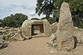
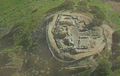
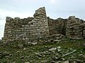
The Necropolis of Monte Luna is an archaeological site located in the surroundings of Senorbì, in Sardinia, near a hill known as Monte Luna (Italian: Moon Mountain). Excavations at this site have unveiled the remainders of a Carthaginian necropolis, comprising about 120 graves. The necropolis was built by the inhabitants of a Carthaginian settlement in the area of modern Santu Teru around the 6th century BC.
Text from Wikipedia, the free encyclopedia, under CC BY-SA 4.0. Full article: «Necropolis of Monte Luna».
Distances are as the crow flies, not walking or driving.
We are missing the opening hours and photos. The data comes from open projects: if you add it there, it appears here at the next update.


Necropolis of Monte Luna is in Senorbì, in the province of Sud Sardegna (Sardinia), Italy. Address: Località Monte Luna 1, Senorbi'. GPS coordinates: 39.51066, 9.14481.
Nearby you’ll find: Nuraghe Piscu (8.9 km away), Necropolis of Pranu Muttedu (12.3 km away), Nuraghe Barru (12.7 km away).
Text. Wikipedia, the free encyclopedia (CC BY-SA 4.0).
Data. Wikidata (CC0); opening hours and contacts OpenStreetMap (ODbL).
Updated 28 October 2026. All sources and licences