Saved

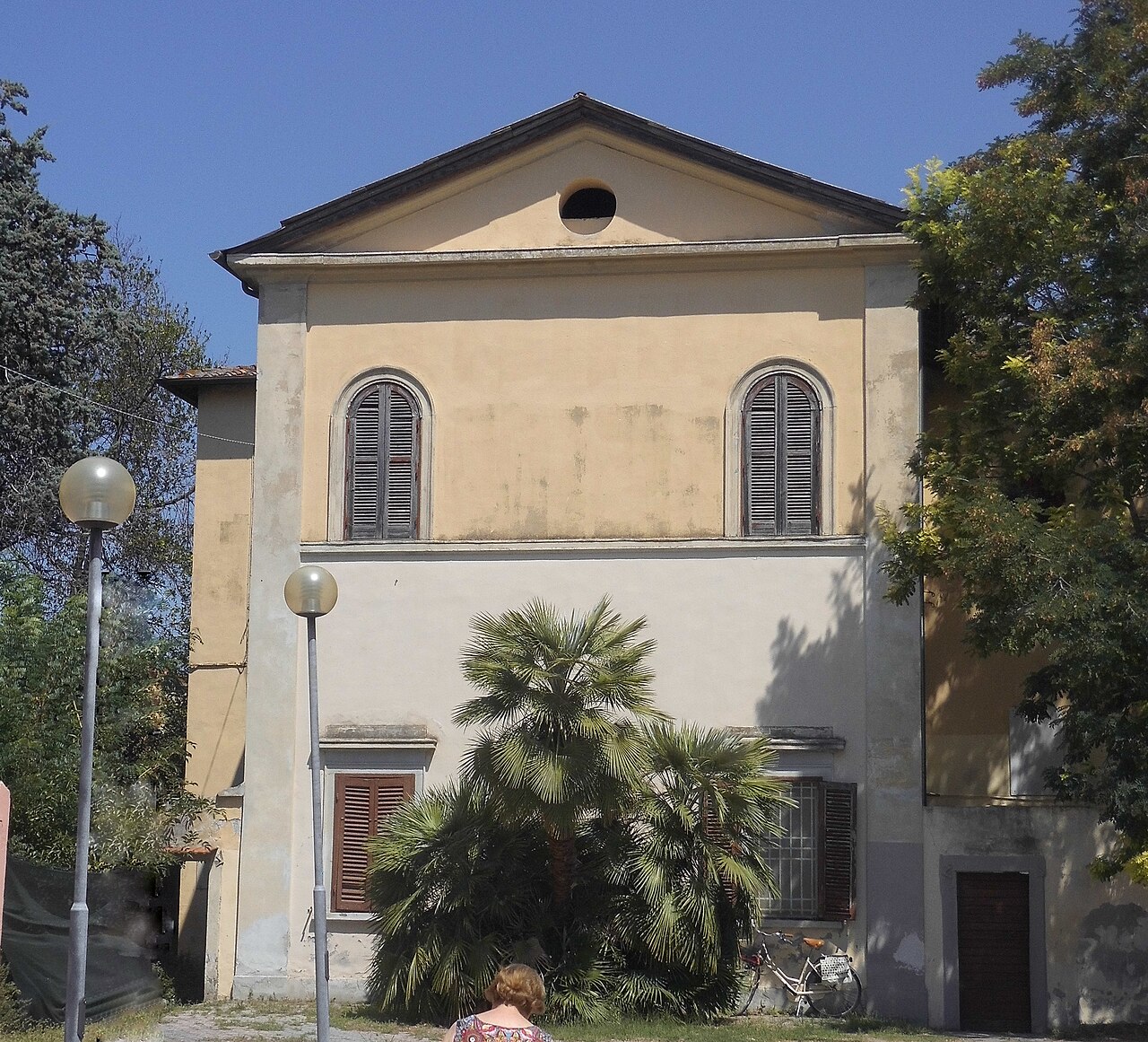
Photo: Ulf Heinsohn, CC BY-SA 4.0 · Wikimedia Commons

Museum, 1992

Museo ebraico Yeshivà Marini

Museum in Italy

Livorno (LI), Tuscany

Directions

At a glance

Type
Museum
Period
Modern era, 1992
Protection
Italian national heritage
Coordinates
43°32′51″ N, 10°19′14″ E
Address
Via Giuseppe Micali, 21

About

No English description yet

Opening hours and directions are on this page. The full story is on Italian Wikipedia.

Read it in Italian

Timeline

  1. 1992Founded

Events and people from Wikidata (CC0).

Getting there

Livorno CentraleTrain, nearest
1.5 km as the crow flies
Museo ebraico Yeshivà MariniVia Giuseppe Micali, 21
Toremar1.5 km
Aeroporto internazionale Galileo Galilei16.4 km

Distances are as the crow flies, not walking or driving.

Loading map…

More museums in Tuscany

Museum, 1930

Museo Galileo

Florence (FI)

Opening hoursAccessible

See all museums in Tuscany

Things to see in Livorno: 106 historic places

Frequently asked questions

Where is Museo ebraico Yeshivà Marini?

Museo ebraico Yeshivà Marini is in Livorno, in the province of Livorno (Tuscany), Italy. Address: Via Giuseppe Micali, 21. GPS coordinates: 43.54764, 10.32047.

What are the opening hours of Museo ebraico Yeshivà Marini?

According to OpenStreetMap the opening hours are: Sep-Jun Su[1] 15:00-17:00. Always check the official website before your visit.

Is Museo ebraico Yeshivà Marini wheelchair accessible?

According to OpenStreetMap data, the site is not wheelchair accessible.

How old is Museo ebraico Yeshivà Marini?

Wikidata dates it to 1992.

What else is there to see near Museo ebraico Yeshivà Marini?

Nearby you’ll find: Fosso Reale (Livorno) (600 m away), Palazzo de Larderel (600 m away), Villa Attias (600 m away).

Sources and licences

Data. Wikidata (CC0); opening hours and contacts OpenStreetMap (ODbL).

Photos. Wikimedia Commons, author and licence on every image.

Credits for the 1 photos
  1. Museo Ebraico Livorno — Ulf Heinsohn, CC BY-SA 4.0

Updated 28 October 2026. All sources and licences

Spotted a mistake? Fix it on OpenStreetMap