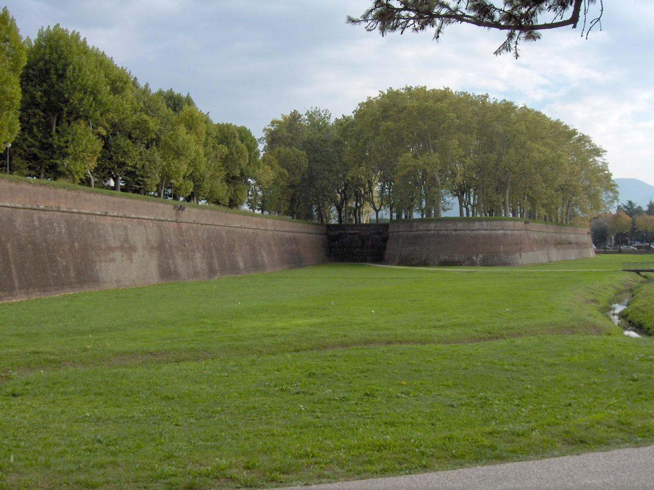


Photo: No machine-readable author provided. JoJan assumed (based on copyright claims)., CC BY-SA 3.0 · Wikimedia Commons
At a glance
- Type
- Fortress / Tower
- Period
- Renaissance, 1513
- Protection
- Italian national heritage
- Coordinates
- 43°50′36″ N, 10°30′53″ E
History and description
The walls of Lucca are a series of stone, brick, and earthwork fortifications surrounding the central city of Lucca in Tuscany, Italy. They are among the best preserved Renaissance fortifications in Europe, and at 4 kilometers and 223 meters in circumference they are the second largest intact example of a fully walled Renaissance city after Nicosia, Cyprus. The current walls of Lucca, which replaced earlier medieval and Roman fortifications, are the result of a construction campaign that started on May 7, 1504, and ended a century and a half later in 1648, with additional structural updates in the second half of the seventeenth century based on new knowledge and construction techniques. These walls play an important role in the cultural identity of the city of Lucca and its surroundings, and as a physical monument to the region's history, and Lucca's longstanding independence as a republic.
The walls were also conceived as a deterrent and have never seen military use. At the time of construction, the Republic of Lucca feared the expansionist aims of the Republic of Florence and subsequently, the Grand Duchy of Tuscany. However, there was never an open war against the Grand Duchy.
The Roman and Medieval Walls
As in many other cities, the Renaissance walls that remain mostly intact today represent only the most recent fortified stage of Lucca. They replaced earlier medieval and Roman fortifications, modernizing and expanding the perimeter protected due to population growth and changing political and economic conditions.
The Roman fortified perimeter was erected as early as 180 BC when the Roman colonia of Luca was founded, and remains visible in the plan of the city streets today, with a northern boundary along Via San Giorgio, an eastern boundary along Via della Rosa and Via dell'Angelo Custode, a southern boundary along Corso Garibaldi, and a western boundary along Via Galli Tassi and Via della Cittadella.
Inside the walls, the typical Roman military castra is identifiable, with its orthogonal north–south cardus maximus and east–west decumanus maximus represented by modern-day Vias Veneto-Calderia-degli Asili and Vias San Paolino-Roma-Santa Croce respectively. These roads intersect at the ancient forum, which remains partly intact today as Piazza San Michele, dominated by the eponymous church of San Michele in Foro.
Short sections of the Roman era walls remain preserved today, incorporated into later structures, notably inside the church of Santa Maria della Rosa and in the basement of the Baluardo di San Colombano.
During the eleventh or twelfth centuries, work began on a new set of walls. The towers were excavated and rebuilt and the embankments were equipped with moats functioning for both water control and defense. These walls expanded to include areas of the city that had grown since Roman settlement with the economic development of Lucca as a stop on the Via Francigena. During the same period Genoa and Pisa also invested in similarly built urban walls. …
The Renaissance Walls
Starting in 1491, modernization of the city walls was deemed necessary in accordance with new techniques of warfare and fortification. In particular, the tall, thin medieval walls were effective for preventing infantry attacks, but were wholly inadequate to resisting cannon fire, which by that time had become a mainstay of siege warfare. Thus, much thicker walls would be necessary for the city to resist an artillery siege.
To coordinate the entire construction process of the modern walls, a specific body was created called "Office of the City and State Fortifications". Established on 7 May 1504 and dismissed three centuries later on 28 January 1801, the Office of Fortifications took care of the entire process of building the wall, and then the sole manager and maintainer. The documents of the Office of Fortifications retrace the construction of the walls day by day, also providing information on the debates of citizens, the construction difficulties encountered and the technical choices made. This body was made up of 6 members, appointed by election, but always chosen from among the group of the most influential families in the city.
The process that led to the construction of the modern walls starts long before the actual construction work and is divided into multiple phases. The fortification campaign began in 1504, but implementation did not start until 1513. First of all, all the local villages were demolished, for a radius of about 1700 meters, so as to provide a wide view of the territory and make room for a broader wall. This process took many years, as there were ecclesiastical buildings and private territories, repaid at a later time following state estimates.
For the design of the enclosure it is possible that consultations were requested from Matteo Civitali and Francesco di Giorgio Martini, but no evidence of actual projects remains. The real phase of construction began in the first half of the 16th century, with curtain wall segments flanked by large bastions allowing for reverse fire. …
Gates of Lucca
Porta San Pietro (1565), in the direction of the railway station (also known as the "steam door" due to the presence of steam trains), currently the headquarters of the Contrade San Paolino association
Porta Sant'Anna, which was opened in 1911 on Piazzale Verdi
Porta San Donato (1629), with piazzale San Donato
It is also possible to enter the city from former posterns in the Renaissance walls, today modified into pedestrian passages and from a passage opened in the nineteenth century to pass a narrow-gauge railway, no longer extant.
Other doors, dating back to earlier walls are still visible within the Renaissance walls:
Antica Porta San Donato (1590), inside Piazza San Donato is the seat of the tourist information office of Lucca
Porta San Gervasio (1198), along via del Fosso at the intersection with via Elisa, dates back to the Middle Ages
Porta dei Borghi (1198) at one end of via Fillungo in the direction of Piazza Santa Maria
The opening of additional doors, which took place only starting in the 19th century, saw numerous debates between citizens and politicians. The theme of the discussions was balancing the safety of the city with the need to open greater direct connections with the territory, in order to respond to the needs of modern mobility.
Bulwarks along the Walls
The baluardi (bastions or bulwarks) are defensive elements of the walls that extend beyond the curtain wall. In the current city walls there are 11 of them. Starting from Porta Santa Maria you will find:
Baluardo San Martino
Baluardo San Pietro
Baluardo San Salvatore: built on a project by Ginese Bresciani starting from 1592. The construction of this bulwark was decidedly problematic because it was plagued by numerous structural problems attributed to an incorrect choice of construction materials. Nearby is the executioner's house.
Baluardo Cairoli: built in 1883 for the purpose of extending the Lucca–Ponte a Moriano tramway through the city.
Baluardo San Regolo
Baluardo San Colombano
Baluardo Santa Maria: designed by Baldassarre Lanci of Urbino and built under the coordination of Vincenzo Civitali. The construction was finished in 1557.
Baluardo San Paolino
Baluardo San Donato: structured on a medieval curtain and designed by Alessandro Farnese, the bulwark was initially built under the supervision of Vincenzo Civitali. To make room for this, the church of San Donato was demolished in 1513, a gesture that brought a lot of discontent in the ecclesiastical circles, which was then rebuilt inside the walls with the name of San Paolino church. In November 1589 we remember a collapse of the structure relating to the bulwark, attributed to the use of incorrect materials and abundant rains. Following this episode, Ginese Bresciani took the place of Vincenzo Civitali.
Text from Wikipedia, the free encyclopedia, under CC BY-SA 4.0. Full article: «City walls of Lucca».
Timeline
- 1513Built
Events and people from Wikidata (CC0).
Photos
Getting there
LuccaTrain, nearest
1.0 km as the crow flies
City walls of Lucca
Aeroporto internazionale Galileo Galilei20.1 km
Distances are as the crow flies, not walking or driving.
Loading map…
Nearby
See on the mapMore fortresses and towers in Tuscany

- UNESCO

- UNESCO


Frequently asked questions
Where is City walls of Lucca?
City walls of Lucca is in Lucca, in the province of Lucca (Tuscany), Italy. GPS coordinates: 43.84335, 10.51476.
How old is City walls of Lucca?
Wikidata dates it to 1513.
What else is there to see near City walls of Lucca?
Nearby you’ll find: Porta Elisa (0 m away), Casa del boia (300 m away), Via Francigena Entry Point - Museum La Casa del Boia (300 m away).
Sources and licences
Text. Wikipedia, the free encyclopedia (CC BY-SA 4.0).
Data. Wikidata (CC0); opening hours and contacts OpenStreetMap (ODbL).
Photos. Wikimedia Commons, author and licence on every image.
Credits for the 9 photos
- Lucca.city walls01 — No machine-readable author provided. JoJan assumed (based on copyright claims)., CC BY-SA 3.0
- Gespa a les muralles de Lucca — Joanbanjo, CC BY-SA 3.0
- Leone con volto, mura di Lucca (01039) — Francesco Tosoni, CC BY-SA 4.0
- Leone senza volto, mura di Lucca (3) — Francesco Tosoni, CC BY-SA 4.0
- Lucca - Mura di Lucca - 2025-09-09 21-56-06 001 — Pardi Marco, CC BY-SA 4.0
- Lucca - muralles — Joanbanjo, CC BY-SA 3.0
- Lucca modern vs roman walls — Bargsnaffle, CC BY-SA 4.0
- 02 Die Stadtbefestigung von Lucca — Holger Uwe Schmitt, CC BY-SA 4.0
- 03 Die Stadtbefestigung von Lucca — Holger Uwe Schmitt, CC BY-SA 4.0
Updated 28 October 2026. All sources and licences