


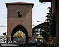


Fortress / Tower, Bologna (BO)
44°30′03″ N, 11°21′22″ E
No photo on Wikimedia Commons yet
Fortress / Tower, 14th century
Mura della città - via Carlo Berti Pichat, Bologna
City walls in Bologna, Italy
Bologna (BO), Emilia-Romagna
At a glance
- Type
- Fortress / Tower
- Period
- Middle Ages, 14th century
- Protection
- Italian national heritage
- Coordinates
- 44°30′03″ N, 11°21′22″ E
- Address
- via Carlo Berti Pichat ‒ Bologna (BO)
Timeline
- 14th centuryBuilt
Events and people from Wikidata (CC0).
Getting there
Bologna ZanoliniTrain, nearest
400 m as the crow flies
Mura della città - via Carlo Berti Pichat, Bolognavia Carlo Berti Pichat ‒ Bologna (BO)
Aeroporto di Bologna "Guglielmo Marconi"6.6 km
Distances are as the crow flies, not walking or driving.
Loading map…
The town
 Things to see in Bologna387,971 inhabitants, 54 m above sea level. 301 historic places in the town.PhotoВвласенко, CC BY-SA 3.0301 places
Nearby
See on the mapDo you know this place?
We are missing the opening hours, a description and photos. The data comes from open projects: if you add it there, it appears here at the next update.
More fortresses and towers in Emilia-Romagna


Frequently asked questions
Where is Mura della città - via Carlo Berti Pichat, Bologna?
Mura della città - via Carlo Berti Pichat, Bologna is in Bologna, in the province of Bologna (Emilia-Romagna), Italy. Address: via Carlo Berti Pichat ‒ Bologna (BO). GPS coordinates: 44.50081, 11.35599.
How old is Mura della città - via Carlo Berti Pichat, Bologna?
Wikidata dates it to the 14th century.
What else is there to see near Mura della città - via Carlo Berti Pichat, Bologna?
Nearby you’ll find: Walls of Bologna (0 m away), Luigi Cattaneo Anatomical Wax Museum (300 m away), Porta San Donato (300 m away).
Sources and licences
Data. Wikidata (CC0); opening hours and contacts OpenStreetMap (ODbL).
Updated 28 October 2026. All sources and licences