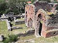



Archaeological site, Massarosa (LU)
43°50′11″ N, 10°21′36″ E
No photo on Wikimedia Commons yet
Archaeological site
Massaciuccoli Romana - Padiglione "Guglielmo Lera"
At a glance
- Type
- Archaeological site
- Coordinates
- 43°50′11″ N, 10°21′36″ E
Getting there
Massarosa-BozzanoTrain, nearest
2.8 km as the crow flies
Massaciuccoli Romana - Padiglione "Guglielmo Lera"
Aeroporto internazionale Galileo Galilei17.1 km
Distances are as the crow flies, not walking or driving.
Loading map…
The town
 Things to see in Massarosa21,732 inhabitants, 10 m above sea level. 8 historic places in the town.Photosailko, CC BY 2.58 places
Nearby
See on the mapDo you know this place?
We are missing the opening hours, a description and photos. The data comes from open projects: if you add it there, it appears here at the next update.
More archaeological sites in Tuscany


- Free 1st Sunday
Frequently asked questions
Where is Massaciuccoli Romana - Padiglione "Guglielmo Lera"?
Massaciuccoli Romana - Padiglione "Guglielmo Lera" is in Massarosa, in the province of Lucca (Tuscany), Italy. GPS coordinates: 43.83630, 10.35996.
Is Massaciuccoli Romana - Padiglione "Guglielmo Lera" wheelchair accessible?
According to OpenStreetMap data, the site is wheelchair accessible.
What else is there to see near Massaciuccoli Romana - Padiglione "Guglielmo Lera"?
Nearby you’ll find: Baths of Massaciuccoli (100 m away), Villa Paolina (2.3 km away), Villa Orlando (4.3 km away).
Sources and licences
Data. Wikidata (CC0); opening hours and contacts OpenStreetMap (ODbL).
Updated 28 October 2026. All sources and licences