




- Free 1st Sunday
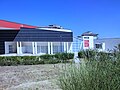
Photo: Vicoduomo at English Wikipedia, Public domain · Wikimedia Commons
In Roman times, Larinum (today Larino) was a thriving and large settlement of ancient origin, located in the hills of the hinterland at an altitude of about 400 m, not far (about 26 km) from the coast of the Adriatic Sea. Due to its strategic location, the settlement was of considerable importance: it stretched over a large, fertile and flat area (today's Piana San Leonardo), overlooking the valley floor and the lower course of the Biferno river. It also served an important road junction, as it was located at the convergence of important road axes, which allowed profitable trade exchanges.
Larinum saw prosperity and economic development, which already reached its peak in the 3rd century BC, likely due to its geographical features, favourable climate and fertile, easy to cultivate soil. This made it a frontier town and a crossroads of cultures, between the Adriatic coast and the inland area of Samnium, always open to the influences of different cultural environments, as confirmed by the archaeological remains, which attest to the existence of a rich and populous town even before the Punic Wars.
The city was located along the so-called via litoranea (also mentioned by Livy), an ancient road that from the north descended along the Adriatic to Histonium (Vasto) and then, by an inland route, after passing Larino, proceeded eastward to Sipontum (Manfredonia) and continued, again along the coast, to Brindisi; this great artery of communication was called Traiana Frentana, an appellation derived from a sepulchral inscription of a certain Marco Blavio, who was one of the curatores of the road connecting Ancona to Brindisi. Moreover, Larinum, through the Biferno valley floor, easily connected with the inland area of Pentrian Samnium, in the direction of Bovianum (Bojano), and by grafting onto the route of the Celano-Foggia sheep-track easily entered into communication with northern Daunia, in the direction of Luceria (Lucera). This dense network of routes defined, therefore, an extensive territory, a crossroads of cultures of various origins, a land of passages and settlements, but always in relationship with neighboring peoples, in a mutual relationship of cultural exchange.
The geomorphological investigations carried out in the territory of Larino have shown how this territory has proven to be propitious both for the choice of inhabited settlements and for the construction of roadways. In fact, the reserves of clay and, to a lesser extent, limestone, present locally, suitable for exploitation in the furnaces, facilitated in ancient times the construction of masonry works, together with the presence of abundant river stones, easily available due to the proximity of the Cigno and Biferno rivers. …
A systematic archaeological exploration of Samnium is a relatively recent initiative, as it was started in the early 1970s and gradually increased in the following decades. The earliest records of collections of prehistoric material of various Molisian provenance are available through surface surveys carried out beginning in 1876 by anthropologist Giustiniano Nicolucci and palethnologist Luigi Pigorini. The latter wrote in that very year complaining of a great poverty of information about the Stone Age in the province of Molise. It consists of eight knives from Larino, a scraper and two knives from Casacalenda and a knife from Montorio nei Frentani. Currently, the material found is partly preserved at the Luigi Pigorini National Prehistoric Ethnographic Museum in Rome and partly at the Anthropological Museum of the University of Naples Federico II.
Subsequently, it was to the credit of the British mission of the University of Sheffield and the team led by archaeologist Graeme Barker, to have conducted a capillary surface reconnaissance, started in 1974, along the wide strip of territory (Pentrian and Frentanian) that constitutes the Biferno Valley (The Biferno Valley Survey), which from the Matese massif reaches the sea, following the course of the Tifernus. Systematic land sampling has led to the identification of about one hundred and twenty ancient settlements of various sizes, covering a period from the Neolithic to the first century B.C. Barker's analysis of the results of the survey offers a picture of an intense peopling of the Frentanian territory gravitating on the lower Biferno valley, where 60 percent of the identified inhabited settlements turn out to be located. Settlement choices seem to be dictated not only by the need to exploit the sites most favorable to cultivation, but also by the intention to keep close to natural communication routes. …
Despite countless archaeological excavations and tests carried out in recent decades in different parts of its urban fabric, it is still difficult to say precisely where and how far the city extended: it is presumable, especially on the basis of the archaeological evidence, that it occupied an area, so to speak, in the shape of a bird's wing, with the amphitheater at the apex (located, therefore, a little on the edge of the town) and the two arms arranged one toward the Montarone hill (the area currently most affected by modern construction) and the other toward Torre Sant'Anna (presumably the area of the Roman town richest in public and private buildings).
This urban conformation was certainly conditioned by the particular sloping terrain and the pre-existence of connecting road routes, which determined the choice of housing sites. Certainly an ancient road connected Torre Sant'Anna with the Biferno valley floor, just as the present road to Montarone serves, as it did then, as a link with the Larino Plain and the Adriatic coast. A third arm of the road, which has survived to the present day, is the one that runs inland from the amphitheater in the direction of Casacalenda, where the Roman necropolis stood, as evidenced by the numerous epigraphs and tombstones found in the late 19th century, when the present railway station was built. …
Text from Wikipedia, the free encyclopedia, under CC BY-SA 4.0. Full article: «Larinum».
Distances are as the crow flies, not walking or driving.


Larinum is in Larino, in the province of Campobasso (Molise), Italy. GPS coordinates: 41.80528, 14.91694.
According to OpenStreetMap the opening hours are: Every day: 8:30–13:30. Always check the official website before your visit.
Nearby you’ll find: Roman amphitheatre of Larino (100 m away), Palazzo Ducale (700 m away), Geronium (6.3 km away).
Text. Wikipedia, the free encyclopedia (CC BY-SA 4.0).
Data. Wikidata (CC0); opening hours and contacts OpenStreetMap (ODbL).
Photos. Wikimedia Commons, author and licence on every image.
Updated 28 October 2026. All sources and licences