


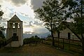


Photo: Daniele Napolitano, CC BY-SA 4.0 · Wikimedia Commons
Archaeological site
Laüs
Ancient Italian city in Calabria
At a glance
- Type
- Archaeological site
- Protection
- Italian national heritage
- Coordinates
- 39°46′03″ N, 15°49′50″ E
- Address
- via degli Scavi ‒ 87020 Santa Maria del Cedro (CS)
History and description
Laüs or Laus (Ancient Greek: Λᾶος; Italian: Laos) was an ancient city on the coast of the Tyrrhenian Sea. It was at the mouth of the Lao River, which formed the boundary between Lucania and Bruttium in ancient times and gave it its name.
The archaeological site of the city can be found at a short distance to the east of Marcellina, near Santa Maria del Cedro in Calabria.
History
Herodotus states that the inhabitants of Sybaris who had survived the destruction of their city in 510 BC took refuge in Laus and Scidrus. Silver coins were found with the legend LAFINON and symbols similar to those of the coins of Sybaris, dated between 500 and 440 BC.
Diodorus Siculus implies that that city had been captured by the Lucanians before or during 390 BC. Thurii had repelled a force of the Lucanians which had attacked their territory in 390 BC. The Lucanians then withdrew to their own territory and Thurians pursued them to lay siege to the "prosperous" town of Laus but on the way the Thurians were ambushed and crushed by the Lucanians.
Pseudo-Scylax writes that it was a colony of Thurii.
Strabo in 7 BC-23 AD describes the city as still being in existence. He mentions a heroon to Draco, a companion of Odysseus. Pliny the Elder in approximately 77–79 AD states that the city no longer existed.
Excavations
The first excavation started between 1929 and 1932. The necropolis of Laus now lies below Marcellina and is notable for its important finds. A rich tomb chamber was discovered by accident in 1961 not far from the railway station of Marcellina, in which were dozens of red-figured vases, bronze and precious metals, and a finely crafted bronze armour. Dated to the second half of the fourth century BC, it is now exhibited in the Museo Nazionale della Magna Grecia in Reggio Calabria. Other burials of the same period, though less rich, were found in the same area in the 1950s and 1960s.
The excavations revealed the city was defended on at least three sides by a wall. The urban space was organised according to a grid plan with at least two central roadways in a north–south orientation and 12 m wide. These were intersected at regular distances of 96 m by perpendicular roads in an east–west orientation and approximately 5 m wide. This created a checkerboard layout of building blocks, which were further separated by narrow lanes. In the south-east of the site, near the present cemetery, an area of artisanal kilns for the production of ceramics was discovered.
Text from Wikipedia, the free encyclopedia, under CC BY-SA 4.0. Full article: «Laüs».
Getting there
Marcellina-Verbicaro-OrsomarsoTrain, nearest
700 m as the crow flies
Laüsvia degli Scavi ‒ 87020 Santa Maria del Cedro (CS)
Distances are as the crow flies, not walking or driving.
Loading map…
Nearby
See on the mapMore archaeological sites in Calabria


Frequently asked questions
Where is Laüs?
Laüs is in Santa Maria del Cedro, in the province of Cosenza (Calabria), Italy. Address: via degli Scavi ‒ 87020 Santa Maria del Cedro (CS). GPS coordinates: 39.76750, 15.83056.
What else is there to see near Laüs?
Nearby you’ll find: Castello San Michele (1.7 km away), Torre Talao (6.2 km away), Cimalonga tower (6.4 km away).
Sources and licences
Text. Wikipedia, the free encyclopedia (CC BY-SA 4.0).
Data. Wikidata (CC0); opening hours and contacts OpenStreetMap (ODbL).
Photos. Wikimedia Commons, author and licence on every image.
Credits for the 1 photos
- SantaMariaDelCedroParcoArcheologicoLaos — Daniele Napolitano, CC BY-SA 4.0
Updated 28 October 2026. All sources and licences