



- UNESCO
Photo: http://pierluigimontalbano.blogspot.com/2010/08/le-spade-di-santiroxi-bronze-age.html, CC BY-SA 3.0 · Wikimedia Commons
Archaeological site
Archaeological site near Decimoputzu, South Sardinia, Italy
Decimoputzu (SU), Sardinia
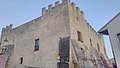
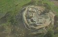
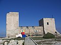
The Hypogeum of Sant'Iroxi (also known as the Tomb of the warriors) is an archaeological site located near the town of Decimoputzu in the province of South Sardinia.
The site (a domus de janas), discovered in 1987, dates back to 3000 BC in the late Neolithic Age, and was used for about 1,500 years by the nearby village to which it belonged, from the Ozieri culture period until that of Bonnannaro.
It owes its name (Tomb of the warriors) to the large number of skeletons (more than 200), deposited in 13 chronological strata, and for the rich military kit, dated to c. 1650-1600 BC, which includes swords and daggers of arsenical copper (19 in all). The swords and triangular blades range in length from 27 up to 66 cm and show some similarities to the swords of the El Argar culture (southeastern Spain). The kit is kept at the National Archaeological Museum of Cagliari.
Text from Wikipedia, the free encyclopedia, under CC BY-SA 4.0. Full article: «Hypogeum of Sant'Iroxi».
Distances are as the crow flies, not walking or driving.


Hypogeum of Sant'Iroxi is in Decimoputzu, in the province of Sud Sardegna (Sardinia), Italy. GPS coordinates: 39.33611, 8.92028.
Nearby you’ll find: Castello di Villasor (5.1 km away), Casteddu de Fanaris (7.1 km away), Castle of Acquafredda (11.9 km away).
Text. Wikipedia, the free encyclopedia (CC BY-SA 4.0).
Data. Wikidata (CC0); opening hours and contacts OpenStreetMap (ODbL).
Photos. Wikimedia Commons, author and licence on every image.
Updated 28 October 2026. All sources and licences