


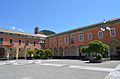


- Most beautiful villages
Photo: Davide Papalini, CC BY-SA 3.0 · Wikimedia Commons
Historic village
Italian comune
Framura is a comune (municipality) in the Province of La Spezia in the Italian region Liguria, located about 50 kilometres (31 mi) southeast of Genoa and about 25 kilometres (16 mi) northwest of La Spezia. As of 31 December 2004, it had a population of 739 and an area of 18.9 square kilometres (7.3 mi2).
The municipality of Framura contains the frazioni (subdivisions, mainly villages and hamlets) Anzo, Ravecca, Setta, Costa, and Castagnola. Framura borders the following municipalities: Bonassola, Carrodano, Deiva Marina, Levanto. It is one of I Borghi più belli d'Italia ("The most beautiful villages of Italy").
During World War II, American 15-men missions called Operations Ginny I and II tried to land and blow up a railway tunnel between Framura and Bonassola. Both missions failed but the second mission's soldiers were executed and buried in a mass grave by the German Army.
Text from Wikipedia, the free encyclopedia, under CC BY-SA 4.0. Full article: «Framura».
Distances are as the crow flies, not walking or driving.


Framura is in Framura, in the province of La Spezia (Liguria), Italy. GPS coordinates: 44.20866, 9.55442.
Nearby you’ll find: Deiva Marina (3.1 km away), Castle of Bonassola (3.5 km away), Ospedale di San Nicolao di Pietra Colice (5.4 km away).
Text. Wikipedia, the free encyclopedia (CC BY-SA 4.0).
Data. Wikidata (CC0); opening hours and contacts OpenStreetMap (ODbL).
Photos. Wikimedia Commons, author and licence on every image.
Updated 28 October 2026. All sources and licences