




Photo: Patafisik, CC BY-SA 4.0 · Wikimedia Commons
Archaeological site
Claternae
Archaeological site in Ozzano dell'Emilia, Italy
At a glance
- Type
- Archaeological site
- Coordinates
- 44°26′04″ N, 11°30′16″ E
- Address
- via Emilia
History and description
Claternae, also called Claterna, was a Roman town on the Via Emilia situated between the coloniae of Bononia and Forum Cornelii. Like many other evenly spaced settlements on the Via Emilia, each at a day's march for the legionaries, it probably arose as a stopping place for travellers between the major towns.
History
The beginning of Roman colonization of Gallia Cisalpina and the building of the Via Emilia perhaps along a pre-existing trail, Claternae was founded at the junction between the Via Emilia and another road, perhaps the Via Flaminia Minor, which crossed the Apennines to provide a link with Arezzo.
Accordingly, the town, of medium size for that period, arose in the early 2nd century BC, officially in 187 BC. It disappeared not long after the 4th-century AD fall of the Western Roman Empire.
Bishopric
Lanzoni argues that, like other towns in the region which were of no greater importance, Claternae was the seat of a diocese, to which he attributes a bishop named Constantius, whom Saint Ambrose, as metropolitan archbishop, directed to make frequent visits to the nearby diocese of Forum Cornelii, which was then without a bishop. No longer a residential bishopric, Claternae is today listed by the Catholic Church as a titular see.
Present situation
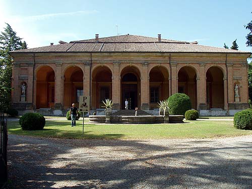
The remains of Claternae lie within the comune of Ozzano dell'Emilia at the hamlet of Maggio and close to the Quaderna stream, which gave the name to the town. An excavated domus with mosaic pavements on the south side of the Via Emilia, and a reconstructed workman's dwelling on the other side are on display. The other remains have been covered up again awaiting funds for their definitive arrangement.
Text from Wikipedia, the free encyclopedia, under CC BY-SA 4.0. Full article: «Claternae».
Photos
Getting there
VarignanaTrain, nearest
1.5 km as the crow flies
Claternaevia Emilia
Aeroporto di Bologna "Guglielmo Marconi"20.5 km
Distances are as the crow flies, not walking or driving.
Loading map…
Nearby
See on the mapMore archaeological sites in Emilia-Romagna

- Free 1st Sunday

- UNESCO


- Free 1st Sunday

Frequently asked questions
Where is Claternae?
Claternae is in Ozzano dell'Emilia, in the province of Bologna (Emilia-Romagna), Italy. Address: via Emilia. GPS coordinates: 44.43444, 11.50451.
What else is there to see near Claternae?
Nearby you’ll find: Museo della città romana di Claterna (2.4 km away), Collection of Anatomical Pathology and Veterinary Teratology (2.9 km away), Villa Torre (5 km away).
Sources and licences
Text. Wikipedia, the free encyclopedia (CC BY-SA 4.0).
Data. Wikidata (CC0); opening hours and contacts OpenStreetMap (ODbL).
Photos. Wikimedia Commons, author and licence on every image.
Credits for the 2 photos
- Claterna abc1 — Patafisik, CC BY-SA 4.0
- Claterna abc4 — Patafisik, CC BY-SA 4.0
Updated 28 October 2026. All sources and licences