




- UNESCO
- Free 1st Sunday
Archaeological site, Ortelle (LE)
40°02′29″ N, 18°24′28″ E
No photo on Wikimedia Commons yet
Distances are as the crow flies, not walking or driving.
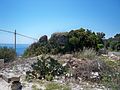
 Things to see in Ortelle2,234 inhabitants, 110 m above sea level. 3 historic places in the town.PhotoLupiae, CC BY-SA 3.03 places
We are missing a description and photos. The data comes from open projects: if you add it there, it appears here at the next update.


Cisternale is in Ortelle, in the province of Lecce (Puglia (Apulia)), Italy. GPS coordinates: 40.04126, 18.40767.
According to OpenStreetMap the opening hours are: Every day: Open 24 hours. Always check the official website before your visit.
According to OpenStreetMap data, the site is wheelchair accessible.
Nearby you’ll find: Palazzo Baronale di Vaste (1.9 km away), Torre Santa Cesarea (4.2 km away), Castello di Castro (4.3 km away).
Data. Wikidata (CC0); opening hours and contacts OpenStreetMap (ODbL).
Updated 28 October 2026. All sources and licences