




- Most beautiful villages
Photo: rachel_thecat, CC BY-SA 2.0 · Wikimedia Commons
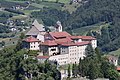
Klausen is an urban comune (municipality) and a village in South Tyrol in northern Italy, located about 20 kilometres (12 mi) northeast of the city of Bolzano. It is one of I Borghi più belli d'Italia ("The most beautiful villages of Italy").
Klausen is first mentioned in 1027, in a document issued by emperor Conrad II, as Clausa sub Sabiona sita, meaning chasm below the Säben Abbey.
The emblem represents an argent dexter key on gules. The emblem was used as a seal from 1448, known from 1397 and granted in 1540 by Cardinal Bernhard von Cles, Bishop of Brixen.
Text from Wikipedia, the free encyclopedia, under CC BY-SA 4.0. Full article: «Klausen».
Distances are as the crow flies, not walking or driving.


Klausen is in Klausen, in the province of Bolzano (Trentino-South Tyrol), Italy. GPS coordinates: 46.63992, 11.56635.
Nearby you’ll find: Branzoll Castle (100 m away), Museo civico di Chiusa (200 m away), Säben Abbey (400 m away).
Text. Wikipedia, the free encyclopedia (CC BY-SA 4.0).
Data. Wikidata (CC0); opening hours and contacts OpenStreetMap (ODbL).
Photos. Wikimedia Commons, author and licence on every image.
Updated 28 October 2026. All sources and licences