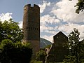
At a glance
Elevation 907 m above sea level
Area 13,220,000 m²
Coordinates 46°40′17″ N, 10°33′14″ E History and description Glurns is an urban comune (Stadt) in South Tyrol in northern Italy, located about 80 kilometres (50 mi) northwest of Bolzano. It is one of I Borghi più belli d'Italia ("The most beautiful villages of Italy").
History The shield is party per pale: the first part represents half Tyrolean Eagle on argent; the second is tierced per fess of sable, argent and gules. The eagle represents the membership of the village to the Tyrol, while the colors sable, argent and gules are those of the city. The emblem was granted in 1528 by Ferdinand I, Holy Roman Emperor.
Keep reading on Wikipedia
Text from Wikipedia, the free encyclopedia, under CC BY-SA 4.0 . Full article: «Glurns» .
Getting there Mals - Malles Venosta Train, nearest
1.5 km as the crow flies
Distances are as the crow flies, not walking or driving.
More historic villages in Trentino-South Tyrol Historic village Borgo Valsugana (TN)
Historic village Kastelruth (BZ)
Historic village Pieve Tesino (TN)
Historic village Tenno (TN)
Historic village Luserna (TN)
Historic village Sterzing (BZ)
See all historic villages in Trentino-South Tyrol
Things to see in Glurns: 7 historic places
Frequently asked questions Where is Glurns? Glurns is in Glurns, in the province of Bolzano (Trentino-South Tyrol), Italy. GPS coordinates: 46.67149, 10.55391.
What else is there to see near Glurns? Nearby you’ll find: Ponte romano sul rio Puni (1.4 km away), Fröhlichsburg (2.2 km away), Churburg (2.8 km away).
Sources and licences Text. Wikipedia, the free encyclopedia (CC BY-SA 4.0 ).
Data. Wikidata (CC0); opening hours and contacts OpenStreetMap (ODbL).
Photos. Wikimedia Commons, author and licence on every image.
Credits for the 9 photos Glurns Stadt 01 — Kuebi, CC BY-SA 3.0 14982 Stadtbefestigung, Glurns, nördöstliche Futtermauer Mura Cittadina, Glorenza Glurns 20220903 0185 — Tilman2007, CC BY-SA 4.0 Glorenza-Glurns, Piazza della Città. - panoramio — Carlo Pelagalli, CC BY-SA 3.0 Glurns Glorenza 20220903 0004 — Tilman2007, CC BY-SA 4.0 2011-04-09 12-32-09 Italy Trentino-Alto Adige Glurns — Hansueli Krapf This file was uploaded with Commonist., CC BY-SA 3.0 2011-04-09 13-24-42 Italy Trentino-Alto Adige Glurns — Hansueli Krapf This file was uploaded with Commonist., CC BY-SA 3.0 2011-04-09 13-25-35 Italy Trentino-Alto Adige Glurns — Hansueli Krapf This file was uploaded with Commonist., CC BY-SA 3.0 Ein Spaziergang durch Glurns in Südtirol. 01 — Holger Uwe Schmitt, CC BY-SA 4.0 Glorenza 07-2011 - panoramio (6) — adirricor, CC BY 3.0 Updated 28 October 2026. All sources and licences
Spotted a mistake? Fix it on OpenStreetMap