
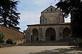




Abbey / Monastery, Veroli (FR)
41°41′35″ N, 13°25′07″ E
No photo on Wikimedia Commons yet
At a glance
- Type
- Abbey / Monastery
- Protection
- Italian national heritage
- Coordinates
- 41°41′35″ N, 13°25′07″ E
History and description
Sant'Erasmo is a Romanesque architecture, Roman Catholic church and convent located on Via Garibaldi in the town of Veroli, province of Frosinone, region of Lazio, Italy.
History
Tradition holds that the monastery was founded around the year 1000 by St Benedict of Nursia during a trip from Subiaco abbey to Montecassino abbey.
The interior of the church has been refurbished over the ages but the exteriors maintain the Romanesque architecture, with a portico with rounded arches. The building was designed by the 12th-century architect Martinus. In 1570, a Eucharistic miracle occurred here. The church was given the title of Collegiata insigne.
Presently, the monastery functions as an inn, with the monastic rooms serving as rooms. The ancient refectory is now a restaurant.
Text from Wikipedia, the free encyclopedia, under CC BY-SA 4.0. Full article: «Sant'Erasmo».
Getting there
FrosinoneTrain, nearest
10.6 km as the crow flies
Sant'Erasmo
Distances are as the crow flies, not walking or driving.
Loading map…
The town
 Things to see in Veroli19,602 inhabitants, 594 m above sea level. 7 historic places in the town.Photoenricohl, CC BY 2.07 places
Nearby
See on the mapDo you know this place?
We are missing the opening hours and photos. The data comes from open projects: if you add it there, it appears here at the next update.
More abbeys and monasteries in Lazio


- Free 1st Sunday


Frequently asked questions
Where is Sant'Erasmo?
Sant'Erasmo is in Veroli, in the province of Frosinone (Lazio), Italy. GPS coordinates: 41.69298, 13.41860.
What else is there to see near Sant'Erasmo?
Nearby you’ll find: Badia di S. Sebastiano (4.4 km away), Casamari Abbey (6.2 km away), Tomb of Sant'Angelo (7 km away).
Sources and licences
Text. Wikipedia, the free encyclopedia (CC BY-SA 4.0).
Data. Wikidata (CC0); opening hours and contacts OpenStreetMap (ODbL).
Updated 28 October 2026. All sources and licences