


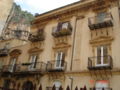


- Most beautiful villages
Photo: Ludvig14, CC BY-SA 4.0 · Wikimedia Commons
Historic village
Italian comune
Cefalù, classically known as Cephaloedium (Ancient Greek: Κεφαλοίδιον, romanized: Kephaloídion), is a city and comune in the Italian Metropolitan City of Palermo, located on the Tyrrhenian coast of Sicily about 70 km (43 mi) east of the provincial capital and 185 km (115 mi) west of Messina. The town, with its population of just under 14,000, is one of the major tourist attractions in the region. Despite its size, every year it attracts millions of tourists from all parts of Sicily, and also from all over Italy and Europe. It is one of I Borghi più belli d'Italia ("The most beautiful villages of Italy").
Of Siculian foundation, in the fourth century BC the Greeks gave the indigenous settlement the name of Kephaloídion, evidently derived from its situation on a lofty and precipitous rock, forming a bold headland (Ancient Greek: κεφαλή, kephalḗ, 'head') projecting into the sea. Despite the Greek origin of its name, no mention of it is found in the works of Thucydides, who says that Himera was the only Greek colony on this coast of the island. It is possible that Cephaloedium was at this time merely a fortress (φρούριον, phroúrion) of Magna Graecia belonging to the Himeraeans and may have been peopled by refugees after the destruction of Himera, who settled alongside the native Sicels.
Its name first appears in history at the time of the Carthaginian expedition under Himilco, 396 BC, when that general concluded a treaty with the Himeraeans and the inhabitants of Cephaloedium. But after the defeat of the Carthaginian armament, Dionysius the Elder made himself master of Cephaloedium, which was betrayed into his hands. At a later period it was again independent, but apparently on friendly terms with the Carthaginians. It was attacked and taken by Agathocles, 307 BC.
In the First Punic War, it was reduced by the Roman fleet under Aulus Atilius Calatinus and Scipio Nasica, 254 BC, but by treachery and not by force of arms. Cicero speaks of it as apparently a flourishing town, enjoying full municipal privileges; it was, in his time, one of the civitates decumanae which paid the tithes of their corn in kind to the Roman state and suffered severely from the oppressions and exactions of Gaius Verres. It also minted coins. No subsequent mention of it is found in history, but it is noticed among the towns of Sicily by the geographers Strabo, Pliny, and Ptolemy, and at a later period its name is still found in the itineraries. …
The Cathedral, begun in 1131, in a style of Norman architecture which would be more accurately called Sicilian Romanesque. The exterior is well preserved, and is largely decorated with interlacing pointed arches; the windows also are pointed. On each side of the façade is a massive tower of four stories. The round-headed Norman portal is worthy of note. A semi-circular apse is set into the east end wall. It has a formidable image of Christ Pantacrator (reminiscent of its Byzantine era). Its strengthening counterforts that work like buttresses, are shaped as paired columns to lighten their aspect. The groined vaulting of the roof is visible in the choir and the right transept, while the rest of the church has a wooden roof. Fine cloisters, coeval with the cathedral, adjoin it.
The interior of the cathedral was restored in 1559, though the pointed arches of the nave, borne by ancient granite columns, are still visible; and the only mosaics preserved are those of the apse and the last bay of the choir; they are remarkably fine specimens of the Byzantine art of the period (1148) and, though restored in 1859–62, have suffered much less than those at Palermo and Monreale from the process. The figure of the Pantocrator gracing the apse is especially noteworthy.
The cathedral is one of nine structures comprising the UNESCO World Heritage Site, Arab-Norman Palermo and the Cathedral Churches of Cefalù and Monreale.
Santa Maria dell'Odigitria, popularly referred to simply as Itria, its name the rendition in Italian of the Greek Hodegetria, one of the standard iconographic depictions of the Virgin Mary. Probably built over a preexisting Byzantine church of the same name, the current building is from the 16th century. Until 1961 it consisted of two different religious edifices, the second being a chapel devoted to St. Michael Archangel; both were a property of the Confraternity of St. Mary of the Odigitria.
Santa Oliva (1787). It has a tuff entrance.
San Sebastiano (probably 1523). It has a single nave with two frescoed niches on every side.
Sant'Andrea.
San Leonardo, mentioned from 1159 and, until the restoration of 1558, dedicated to St. George. The original portal, now closed behind a wall, has vegetable decorations similar to the Cathedral's ones.
The Immacolatella (1661). …
Text from Wikipedia, the free encyclopedia, under CC BY-SA 4.0. Full article: «Cefalù».
Distances are as the crow flies, not walking or driving.


Cefalù is in Cefalù, in the province of Palermo (Sicily), Italy. GPS coordinates: 38.03948, 14.02206.
Nearby you’ll find: Palazzo Pirajno (0 m away), Town hall of Cefalù (0 m away), Palazzo Maria (0 m away).
Text. Wikipedia, the free encyclopedia (CC BY-SA 4.0).
Data. Wikidata (CC0); opening hours and contacts OpenStreetMap (ODbL).
Photos. Wikimedia Commons, author and licence on every image.
Updated 28 October 2026. All sources and licences