




- UNESCO
Castle, Camastra (AG)
37°16′20″ N, 13°48′29″ E
No photo on Wikimedia Commons yet
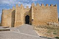
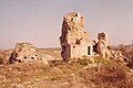
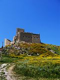
The Castellazzo di Camastra is a castle in Camastra, Sicily. It was built in the 14th century, and it now lies in ruins.
The Castellazzo was built in the 14th century on the edge of a rocky plateau to control the surrounding estates. The oldest reference to a turris Camastra dates back to 1366, and in 1374 the area was in the possession of the nobleman Manfredi Chiaramonte.
The site of the Castellazzo has been identified with the legendary city of Camico.
The Castellazzo consists of an irregular pentagonal tower, which is made up of stones bound together by mortar. Parts of the structure also consist of Cyclopean masonry. Some of the remaining walls are up to 3.5m high.
Text from Wikipedia, the free encyclopedia, under CC BY-SA 4.0. Full article: «Castellazzo di Camastra».
Distances are as the crow flies, not walking or driving.
We are missing the opening hours and photos. The data comes from open projects: if you add it there, it appears here at the next update.


Castellazzo di Camastra is in Camastra, in the province of Agrigento (Sicily), Italy. Address: via Naro Camastra. GPS coordinates: 37.27212, 13.80794.
Nearby you’ll find: Porta d'Oro (2.7 km away), Museo civico della città di Naro (3.1 km away), Castle of Naro (3.1 km away).
Text. Wikipedia, the free encyclopedia (CC BY-SA 4.0).
Data. Wikidata (CC0); opening hours and contacts OpenStreetMap (ODbL).
Updated 28 October 2026. All sources and licences