


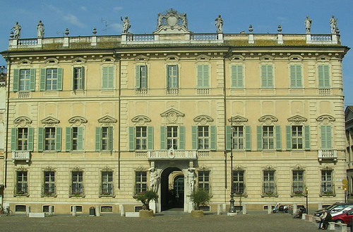



Photo: Massimo Telò, CC BY-SA 4.0 · Wikimedia Commons
Fortress / Tower, 1280
Casa torre dei Bonacolsi
- Within the UNESCO World Heritage Site “Mantua and Sabbioneta”
At a glance
- Type
- Fortress / Tower
- Period
- Middle Ages, 1280
- Coordinates
- 45°09′37″ N, 10°47′46″ E
About
No English description yet
Opening hours and directions are on this page. The full story is on Italian Wikipedia.
Read it in ItalianTimeline
- 1280Built
Events and people from Wikidata (CC0).
Getting there
MantovaTrain, nearest
1.0 km as the crow flies
Casa torre dei Bonacolsi
Escursioni in barca7.8 km
Aeroporto Valerio Catullo di Verona-Villafranca27.2 km
Distances are as the crow flies, not walking or driving.
Loading map…
Nearby
See on the mapMore fortresses and towers in Lombardy


- UNESCO

- UNESCO

- UNESCO

Frequently asked questions
Where is Casa torre dei Bonacolsi?
Casa torre dei Bonacolsi is in Mantua, in the province of Mantova (Lombardy), Italy. GPS coordinates: 45.16029, 10.79610.
How old is Casa torre dei Bonacolsi?
Wikidata dates it to 1280.
What else is there to see near Casa torre dei Bonacolsi?
Nearby you’ll find: Palazzo Bonacolsi (0 m away), Ca' degli Uberti (100 m away), Palazzo Bianchi (100 m away).
Sources and licences
Data. Wikidata (CC0); opening hours and contacts OpenStreetMap (ODbL).
Photos. Wikimedia Commons, author and licence on every image.
Credits for the 1 photos
- Mantova-Casa-Torre dei Bonacolsi — Massimo Telò, CC BY-SA 4.0
Updated 28 October 2026. All sources and licences