




- UNESCO
Photo: Cristiano Cani, CC BY 2.0 · Wikimedia Commons
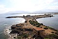
Bithia or Bitia was a Phoenician, Carthaginian, and Roman town located near Chia in the extreme south of Sardinia, Italy. Most of the ruins have been submerged underwater.
Bithia was founded by the Phoenicians in the 8th century BC as Bitan (Punic: 𐤁𐤉𐤕𐤏𐤍, bytʿn, "Palace"). It fell under Carthaginian control until the Punic Wars, when it became Roman. Punic culture survived well into the Roman period. It was abandoned in the early 7th century, when the population fled inland to escape Arab raids.
In 1963, following heavy storms, some ruins of the city came to light. Still observable are the remains of a Punic temple on the island of Cardolinu, on which are also found artifacts that seem to indicate the presence of a tophet. Additional remains of houses and a second temple dedicated to Bes are located at the foot of the promontory on which stands the Spanish tower called "Chia", the current name of the modern village.
Text from Wikipedia, the free encyclopedia, under CC BY-SA 4.0. Full article: «Bithia».
Our data shows no stations, stops or car parks nearby. Check how to get there before you set out.


Bithia is in Domus de Maria, in the province of Sud Sardegna (Sardinia), Italy. GPS coordinates: 38.89583, 8.88528.
Nearby you’ll find: Chia Tower (100 m away), Torre di Cala d'Ostia (9.3 km away), Nuraghe Sa Perdaia (10.9 km away).
Text. Wikipedia, the free encyclopedia (CC BY-SA 4.0).
Data. Wikidata (CC0); opening hours and contacts OpenStreetMap (ODbL).
Photos. Wikimedia Commons, author and licence on every image.
Updated 28 October 2026. All sources and licences