Saved
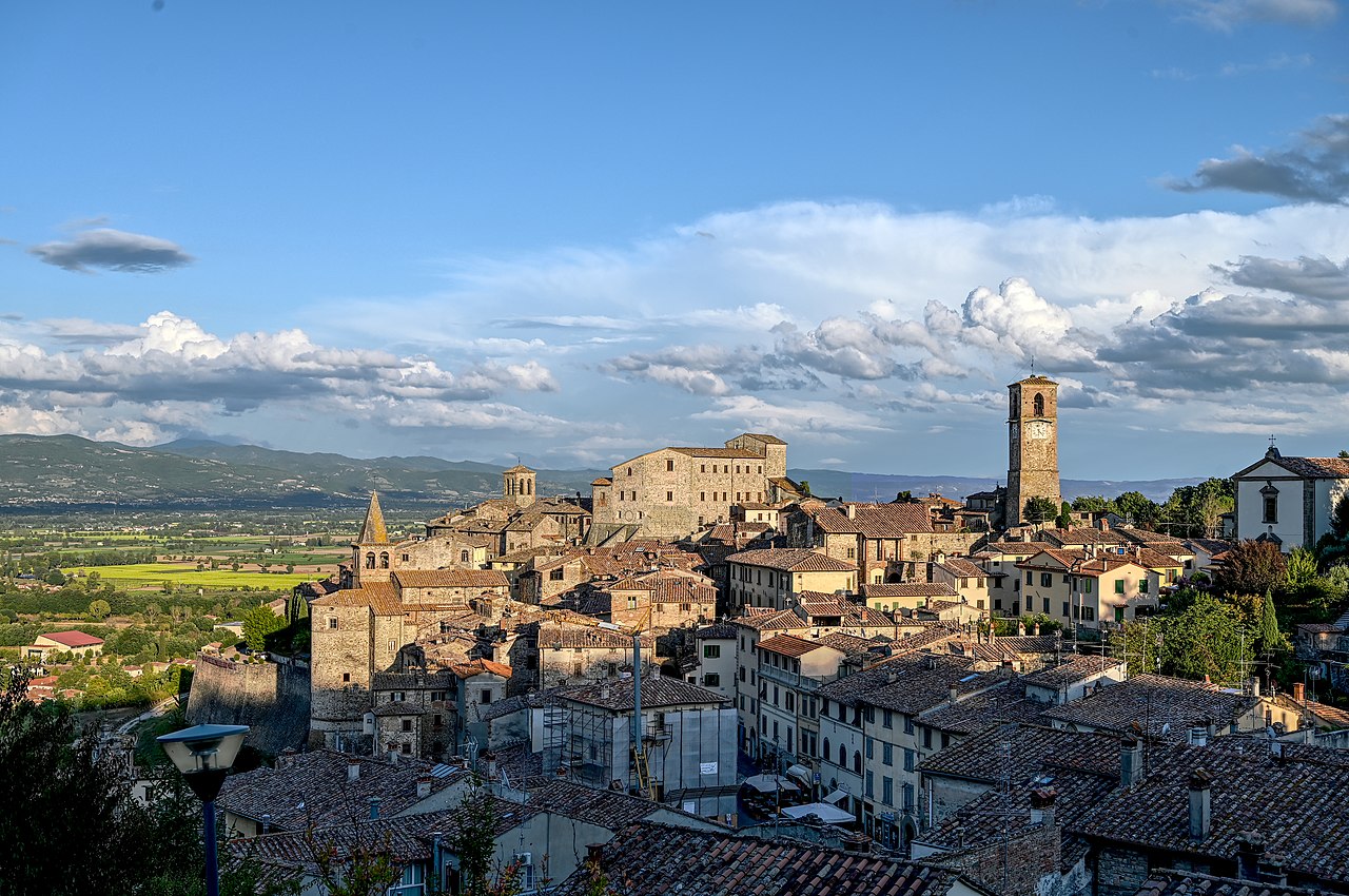
Anghiari
  • Most beautiful villages in Italy
Original photo1 of 9 photos

Photo: TeKappa, CC BY-SA 4.0 · Wikimedia Commons

Historic village

Anghiari

Italian comune

Anghiari (AR), Tuscany

Directions

At a glance

Elevation
429 m above sea level
Area
130,920,000 m²
Coordinates
43°32′30″ N, 12°03′18″ E
Address
Piazza Mameli, 1, 52031 Anghiari

History and description

Anghiari is a hill town and municipality (comune) in the Province of Arezzo, Tuscany, Italy.

Bordering comuni include Arezzo (southwest), Pieve Santo Stefano (north) and Subbiano (west). It is one of I Borghi più belli d'Italia ("The most beautiful villages of Italy").

History

The Battle of Anghiari took place on 29 June 1440 between the Republic of Florence and the Duchy of Milan. The battle inspired a Leonardo da Vinci fresco designed for Florence's Palazzo Vecchio known as the Lost Leonardo; current scholarship holds that the work was never completed. It is known from da Vinci drafts and a sketch of it by Peter Paul Rubens now in the Louvre.

During World War II, the concentration camp of Renicci was located at Anghiari.

Keep reading on Wikipedia

Text from Wikipedia, the free encyclopedia, under CC BY-SA 4.0. Full article: «Anghiari».

Photos

Getting there

AnghiariTrain, nearest
700 m as the crow flies
AnghiariPiazza Mameli, 1, 52031 Anghiari

Distances are as the crow flies, not walking or driving.

Loading map…

More historic villages in Tuscany

  • Most beautiful villages
Historic village

Suvereto

Suvereto (LI)

  • Most beautiful villages
Historic village

Barga

Barga (LU)

  • Most beautiful villages
Historic village

Buonconvento

Buonconvento (SI)

  • Most beautiful villages
Historic village

Pitigliano

Pitigliano (GR)

See all historic villages in Tuscany

Things to see in Anghiari: 18 historic places

Frequently asked questions

Where is Anghiari?

Anghiari is in Anghiari, in the province of Arezzo (Tuscany), Italy. Address: Piazza Mameli, 1, 52031 Anghiari. GPS coordinates: 43.54167, 12.05500.

Is Anghiari wheelchair accessible?

According to OpenStreetMap data, the site is partly wheelchair accessible.

What else is there to see near Anghiari?

Nearby you’ll find: Teatro dell'Accademia dei Ricomposti (100 m away), Palazzo Marzocco (100 m away), Museo delle Memorie e del paesaggio (100 m away).

Sources and licences

Text. Wikipedia, the free encyclopedia (CC BY-SA 4.0).

Data. Wikidata (CC0); opening hours and contacts OpenStreetMap (ODbL).

Photos. Wikimedia Commons, author and licence on every image.

Credits for the 9 photos
  1. Anghiari, AR — TeKappa, CC BY-SA 4.0
  2. 52031 Anghiari AR, Italy - panoramio (1) — blogmasterpg, CC BY-SA 3.0
  3. Anghiari - chiesa di Santa Maria delle Grazie - 2026-09-10 20-31-18 001 — TeKappa, CC BY-SA 4.0
  4. Anghiari - Comune di Anghiari - 2023-09-27 10-59-38 001 — TeKappa, CC BY-SA 4.0
  5. Anghiari - Comune di Anghiari - 2024-09-23 07-43-13 001 — TeKappa, CC BY-SA 4.0
  6. Anghiari - Comune di Anghiari - 2024-09-26 17-33-08 001 — TeKappa, CC BY-SA 4.0
  7. Anghiari - Comune di Anghiari - 2024-09-29 16-03-27 001 — TeKappa, CC BY-SA 4.0
  8. Anghiari - Comune di Anghiari - 2024-09-30 22-49-02 001 — TeKappa, CC BY-SA 4.0
  9. Anghiari - Comune di Anghiari - 2024-09-30 23-14-20 001 — TeKappa, CC BY-SA 4.0

Updated 28 October 2026. All sources and licences

Spotted a mistake? Fix it on OpenStreetMap