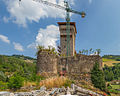
At a glance
Period Renaissance, 16th century
Protection Italian national heritage
Coordinates 44°07′09″ N, 11°52′58″ E
Address via Guerra ‒ Dovadola (FC) About No English description yet Opening hours and directions are on this page. The full story is on Italian Wikipedia.
Read it in Italian Timeline 16th century Built
Events and people from Wikidata (CC0 ).
Getting there Brisighella Train, nearest
14.4 km as the crow flies
Abbazia di Sant'Andrea via Guerra ‒ Dovadola (FC)
Aeroporto Luigi Ridolfi 17.2 km
Distances are as the crow flies, not walking or driving.
More abbeys and monasteries in Emilia-Romagna Abbey / Monastery, 6th century Ravenna (RA)
Abbey / Monastery, 9th century Codigoro (FE)
Abbey / Monastery, 1228 Bologna (BO)
Abbey / Monastery, 7th century Bobbio (PC)
Abbey / Monastery, 8th century Nonantola (MO)
Abbey / Monastery, 12th century Forlì (FC)
See all abbeys and monasteries in Emilia-Romagna
Things to see in Dovadola: 6 historic places
Frequently asked questions Where is Abbazia di Sant'Andrea? Abbazia di Sant'Andrea is in Dovadola, in the province of Forlì-Cesena (Emilia-Romagna), Italy. Address: via Guerra ‒ Dovadola (FC). GPS coordinates: 44.11906, 11.88267.
How old is Abbazia di Sant'Andrea? Wikidata dates it to the 16th century.
What else is there to see near Abbazia di Sant'Andrea? Nearby you’ll find: Rocca di Dovadola (600 m away), Castellaccio (7.4 km away), Stronghold of Castrocaro (7.6 km away).
Sources and licences Data. Wikidata (CC0); opening hours and contacts OpenStreetMap (ODbL).
Photos. Wikimedia Commons, author and licence on every image.
Credits for the 6 photos Chiesa di Sant'Andrea (Dovadola), esterno 01 — Mongolo1984, CC BY-SA 4.0 Abbazia di Sant'Andrea a Dovadola (campanile) — Gloriascaioli, CC BY-SA 4.0 Abbazia di Sant'Andrea a Dovadola (facciata) — Gloriascaioli, CC BY-SA 4.0 Campanile della chiesa di Sant'Andrea (Dovadola) 01 — Mongolo1984, CC BY-SA 4.0 Chiesa di Sant'Andrea (Dovadola), esterno 02 — Mongolo1984, CC BY-SA 4.0 Epigrafe, 1690, Chiesa di Sant'Andrea (Dovadola) — Mongolo1984, CC BY-SA 4.0 Updated 28 October 2026. All sources and licences
Spotted a mistake? Fix it on OpenStreetMap