Saved
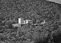
San Salvatore di Montecorona
Original photo1 of 6 photos

Photo: LigaDue, CC BY-SA 4.0 · Wikimedia Commons

Abbey / Monastery, 1008

San Salvatore di Montecorona

Church and abbey in Umbertide

Umbertide (PG), Umbria

Directions

At a glance

Period
Middle Ages, 1008
Style
Romanesque architecture
Dedicated to
Jesus Christ
Coordinates
43°17′00″ N, 12°21′19″ E

About

No English description yet

Opening hours and directions are on this page. The full story is on Italian Wikipedia.

Read it in Italian

Timeline

  1. 1008Built

Events and people from Wikidata (CC0).

Photos

Getting there

MontecoronaTrain, nearest
600 m as the crow flies
San Salvatore di Montecorona
Aeroporto Internazionale dell'Umbria - Perugia "San Francesco d'Assisi"24.1 km

Distances are as the crow flies, not walking or driving.

Loading map…

More abbeys and monasteries in Umbria

See all abbeys and monasteries in Umbria

Things to see in Umbertide: 23 historic places

Frequently asked questions

Where is San Salvatore di Montecorona?

San Salvatore di Montecorona is in Umbertide, in the province of Perugia (Umbria), Italy. GPS coordinates: 43.28345, 12.35522.

How old is San Salvatore di Montecorona?

Wikidata dates it to 1008.

What else is there to see near San Salvatore di Montecorona?

Nearby you’ll find: Santa Croce (3.3 km away), Rocca of Umbertide (3.4 km away), Castle of Antognolla (6.1 km away).

Sources and licences

Data. Wikidata (CC0); opening hours and contacts OpenStreetMap (ODbL).

Photos. Wikimedia Commons, author and licence on every image.

Credits for the 6 photos
  1. UmbertideSanSalvatoreMontecorona5 — LigaDue, CC BY-SA 4.0
  2. Abbazia Montecorona Provincia Perugia cripta inferiore — Celeste Alessandri, CC BY-SA 4.0
  3. San Salvatore di Montecorona, campanile, DSC 10501 — Maurobifani, CC BY-SA 4.0
  4. Umbertide - Abbazia di Montecorona - 001 — Diego Baglieri, CC BY-SA 4.0
  5. UmbertideSanSalvatoreMontecorona1 — LigaDue, CC BY-SA 4.0
  6. UmbSanSalvatoreDiMonteCorona1 — Ziegler175, CC BY-SA 3.0

Updated 28 October 2026. All sources and licences

Spotted a mistake? Fix it on OpenStreetMap