



- Free 1st Sunday
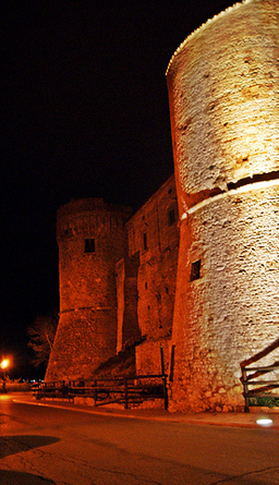
Photo: Pietro, CC BY-SA 3.0 · Wikimedia Commons
Abbey / Monastery, 1257
Abbey in San Salvo (CH), Italy
The Abbey of Santi Vito e Salvo (Italian: Abbazia dei Santi Vito e Salvo) was a Cistercian monastery located in San Salvo, Province of Chieti, Italy.
It was founded in 1247 by the mother abbey Santa Maria della Ferraria in Campania, of the line of Abbey of Clairvaux.
At the beginnings, the location selected for the abbey was in a swampy area close to San Salvo, but the harsh living conditions pushed the monks to move inside the town.
The abbey developed in the area nowadays known as "il quadrilatero", but it was abandoned in 1453 after an attack launched by the Turks.
The structures of the abbey are completely lost, with new buildings constructed around the squared area of the original closter.
The new church of San Giuseppe was built in place of the previous one: the only remains of the original building are two lancet windows on the side of the church. The original well of the abbey was discovered during recent excavations.
Text from Wikipedia, the free encyclopedia, under CC BY-SA 4.0. Full article: «Abbey of Saint Vitus and Salvo».
Events and people from Wikidata (CC0).
Distances are as the crow flies, not walking or driving.


Abbey of Saint Vitus and Salvo is in San Salvo, in the province of Chieti (Abruzzo), Italy. GPS coordinates: 42.04491, 14.73150.
Wikidata dates it to 1257.
Nearby you’ll find: Parco archeologico del Quadrilatero (0 m away), Torre di Bassano (7.6 km away), Palazzo d'Avalos (7.6 km away).
Text. Wikipedia, the free encyclopedia (CC BY-SA 4.0).
Data. Wikidata (CC0); opening hours and contacts OpenStreetMap (ODbL).
Photos. Wikimedia Commons, author and licence on every image.
Updated 28 October 2026. All sources and licences