Saved
Villa Rosa
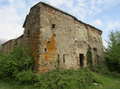
Original photo1 of 5 photos

Photo: Davide Papalini, CC BY 2.5 · Wikimedia Commons

Historic villa / palace, 1905

Villa Rosa

Villa in Altare, Italy

Altare (SV), Liguria

Directions

At a glance

Period
Modern era, 1905
Style
Art Nouveau architecture
Commissioned by
Giuseppe Bertolotti
Protection
Italian national heritage
Coordinates
44°20′10″ N, 8°20′32″ E
Address
Piazza del Consolato, 2-4, Altare (SV)

Timeline

  1. 1905Built

Events and people from Wikidata (CC0).

Photos

Getting there

AltareTrain, nearest
700 m as the crow flies
Villa RosaPiazza del Consolato, 2-4, Altare (SV)

Distances are as the crow flies, not walking or driving.

Loading map…

Do you know this place?

We are missing the opening hours and a description. The data comes from open projects: if you add it there, it appears here at the next update.

More historic villas and palaces in Liguria

Historic villa / palace, 1783

Doge's Palace

Genoa (GE)

Accessible

See all historic villas and palaces in Liguria

Things to see in Altare: 7 historic places

Frequently asked questions

Where is Villa Rosa?

Villa Rosa is in Altare, in the province of Savona (Liguria), Italy. Address: Piazza del Consolato, 2-4, Altare (SV). GPS coordinates: 44.33620, 8.34209.

How old is Villa Rosa?

Wikidata dates it to 1905.

What else is there to see near Villa Rosa?

Nearby you’ll find: Arte Vetraria Museum (0 m away), Altare Castle (200 m away), Forte Tagliata di Altare (800 m away).

Sources and licences

Data. Wikidata (CC0); opening hours and contacts OpenStreetMap (ODbL).

Photos. Wikimedia Commons, author and licence on every image.

Credits for the 5 photos
  1. Altare (SV)-IMG 0874 — Davide Papalini, CC BY 2.5
  2. Villa Rosa, Altare — MadBob, CC BY-SA 4.0
  3. 8 museo vetro altare bovindo 02 — Karloskarate Carlo Marchesano Savona, CC BY-SA 4.0
  4. Museo del vetro di Altare — Fotoscot, CC BY-SA 4.0
  5. Museo dell'Arte Vetraria — Fotoscot, CC BY-SA 4.0

Updated 28 October 2026. All sources and licences

Spotted a mistake? Fix it on OpenStreetMap