
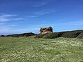


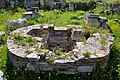
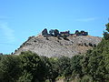
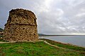


Photo: brittonpaul83, CC BY-SA 2.0 · Wikimedia Commons
At a glance
- Type
- Fortress / Tower
- Protection
- Italian national heritage
- Coordinates
- 40°10′39″ N, 8°27′31″ E
- Address
- Strada Torre Foghe
Photos
Getting there
NigolosuTrain, nearest
10.2 km as the crow flies
Torre di FogheStrada Torre Foghe
Aeroporto di Oristano-Fenosu35.1 km
Distances are as the crow flies, not walking or driving.
Loading map…
Nearby
See on the mapMore fortresses and towers in Sardinia


Frequently asked questions
Where is Torre di Foghe?
Torre di Foghe is in Tresnuraghes, in the province of Oristano (Sardinia), Italy. Address: Strada Torre Foghe. GPS coordinates: 40.17759, 8.45866.
What are the opening hours of Torre di Foghe?
According to OpenStreetMap the opening hours are: Every day: Open 24 hours. Always check the official website before your visit.
What else is there to see near Torre di Foghe?
Nearby you’ll find: Torre di Capo Nieddu (2.6 km away), Nuraghe Oratiddo (5.4 km away), Torre di Santa Caterina di Pittinuri (8.4 km away).
Sources and licences
Data. Wikidata (CC0); opening hours and contacts OpenStreetMap (ODbL).
Photos. Wikimedia Commons, author and licence on every image.
Credits for the 9 photos
- Tresnuraghes - Torre di Foghe (2) — brittonpaul83, CC BY-SA 2.0
- Torre di Foghe 1 — Air fans, CC0
- TORRE FOGHE (TRESNURAGHES) - panoramio — fadda domenico ange…, CC BY-SA 3.0
- Tresnuraghes - Torre di Foghe (1) — brittonpaul83, CC BY-SA 2.0
- PUNTA FOGHE - panoramio — fadda domenico ange…, CC BY-SA 3.0
- RIU MANNU -PUNTA FOGHE - panoramio — fadda domenico ange…, CC BY-SA 3.0
- Tresnuraghes, Località Foghe - foce del Rio Mannu — Giuseppe Cadau, Public domain
- VISTA DA PUNTA FOGHE, F. CORONA NIEDDA - panoramio — fadda domenico ange…, CC BY-SA 3.0
- CostaFoghe1 — Public domain
Updated 28 October 2026. All sources and licences