


- Free 1st Sunday
Abbey / Monastery, Campo di Giove (AQ)
42°01′44″ N, 14°03′43″ E
No photo on Wikimedia Commons yet
Abbey / Monastery, 1250s
Monastic grange at Campo di Giove (AQ)
Campo di Giove (AQ), Abruzzo
Events and people from Wikidata (CC0).
Distances are as the crow flies, not walking or driving.
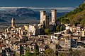
 Things to see in Campo di Giove739 inhabitants, 1,064 m above sea level. 1 historic place in the town.PhotoDavipar, Public domain1 place
We are missing the opening hours, a description and photos. The data comes from open projects: if you add it there, it appears here at the next update.


Sant'Antonino di Campo di Giove is in Campo di Giove, in the province of L'Aquila (Abruzzo), Italy. GPS coordinates: 42.02901, 14.06186.
Wikidata dates it to 1250s.
Nearby you’ll find: Caldora-Cantelmo Castle (6 km away), Pacentro (6.3 km away), Ocriticum (6.6 km away).
Data. Wikidata (CC0); opening hours and contacts OpenStreetMap (ODbL).
Updated 28 October 2026. All sources and licences