



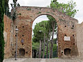

Photo: Uomodis08, CC BY 3.0 · Wikimedia Commons
Castle, 15th century
Rocca Malatestiana
Fourteenth century fortress in Cesena, Italy
Cesena (FC), Emilia-Romagna
At a glance
- Type
- Castle
- Period
- Middle Ages, 15th century
- Architect
- Matteo Nuti
- Protection
- Italian national heritage
- Coordinates
- 44°08′11″ N, 12°14′24″ E
- Address
- piazza del Popolo ‒ Cesena (FC)
About
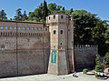
The Rocca Malatestiana ("Malatestian Stronghold") is a fortress in Cesena, Italy. The current structure is the third fortress built on the site, near the remains of two earlier ones dating to the late Roman and medieval periods.
One of the most imposing fortresses in Romagna, it features a courtyard and two main towers, known as the "Male" and the "Female". The "Female" tower houses the Museum of Agriculture, which presents rural life in Romagna across different eras, while the "Male" tower contains a permanent exhibition of Malatestian ceramics.
Text from Wikipedia, the free encyclopedia, under CC BY-SA 4.0. Full article: «Rocca Malatestiana».
Timeline
- 15th centuryBuilt
People
Events and people from Wikidata (CC0).
Photos
Getting there
CesenaTrain, nearest
1.2 km as the crow flies
Rocca Malatestianapiazza del Popolo ‒ Cesena (FC)
Aeroporto Luigi Ridolfi15.0 km
Distances are as the crow flies, not walking or driving.
Loading map…
Nearby
See on the mapMore castles in Emilia-Romagna

- Free 1st Sunday


Frequently asked questions
Where is Rocca Malatestiana?
Rocca Malatestiana is in Cesena, in the province of Forlì-Cesena (Emilia-Romagna), Italy. Address: piazza del Popolo ‒ Cesena (FC). GPS coordinates: 44.13642, 12.24008.
How old is Rocca Malatestiana?
Wikidata dates it to the 15th century.
What else is there to see near Rocca Malatestiana?
Nearby you’ll find: Torrione del Nuti (100 m away), Parco archeologico del Colle Garampo (100 m away), Museo di storia dell'agricoltura (100 m away).
Sources and licences
Text. Wikipedia, the free encyclopedia (CC BY-SA 4.0).
Data. Wikidata (CC0); opening hours and contacts OpenStreetMap (ODbL).
Photos. Wikimedia Commons, author and licence on every image.
Credits for the 9 photos
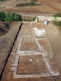
- Rocca Malatestiana - Aerial view — Uomodis08, CC BY 3.0
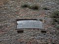
- Caper plant on the defensive wall of the Rocca Malatestiana (heading NE 45) — Terragio67, CC BY-SA 4.0
- Cesena - Rocca Malatestiana - 2024-09-29 19-42-23 001 — Terragio67, CC BY-SA 4.0
- Cesena, rocca malatestiana, fossato, lapide 3 settembre 1944 — Sailko, CC BY-SA 3.0
- Cesena, rocca malatestiana, fossato, mura 01 — Sailko, CC BY-SA 3.0
- Cesena, rocca malatestiana, fossato, mura, lapide di renato seppa (rotta dal terremoto del 2012) — Sailko, CC BY-SA 3.0
- Cesena, rocca malatestiana, ingresso al torrione di sant'agostino 01 — Sailko, CC BY-SA 3.0
- Cesena, rocca malatestiana, ingresso al torrione di sant'agostino 02 strombatura — Sailko, CC BY-SA 3.0
- Cesena, rocca malatestiana, ingresso del torrione della lumaca — Sailko, CC BY-SA 3.0
Updated 28 October 2026. All sources and licences